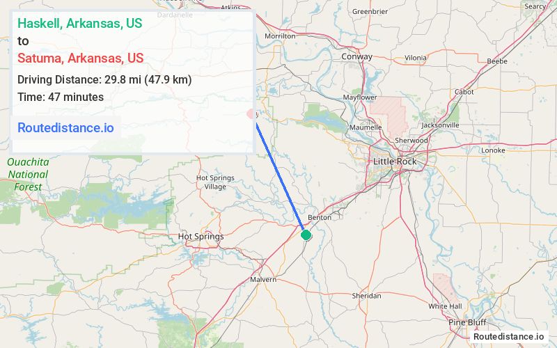
Distance from Haskell, Arkansas to Satuma, Arkansas
The driving distance from Haskell, Arkansas to Satuma, Arkansas is 44.8 mi (72.1 km)
The straight-line (air) distance is approximately 18.5 mi (29.8 km)
Estimated travel time by road is 58 minutes
We found 3 routes between Haskell and Satuma.
Available Routes
Route Directions
Take AR-5 and AR-9 N to AR-324 W in Perry County
Take Blue Jay Hollow Rd to Satuma Mountain Rd
Route Directions
Take US-67 S to Crossroads
Follow Crossroads to US-70 W
Follow AR-9 N to AR-324 W in Perry County
Take Blue Jay Hollow Rd to Satuma Mountain Rd
Route Directions
Take I-30 E, Brazil Rd, Steel Bridge Rd, State Hwy 298 and AR-9 N to AR-324 W in Perry County
Take Blue Jay Hollow Rd to Satuma Mountain Rd
Journey Details
Traveling from Haskell, Arkansas to Satuma, Arkansas covers 42.4 miles (68 km) in a northwest direction. This mixed highways and local roads, moderate route typically takes 1 hour 1 minute under normal conditions.
Drivers have 3 route options between these locations (42-45 miles / 68-72 km). The primary route shown here saves no time compared to alternatives.
The route features scenic views. During midday weekend travel, expect typical weekend traffic patterns with average speeds around 44 mph (71 km/h) .
Journey Waypoints
Haskell
Starting Point
Satuma
Destination
Route Map Image