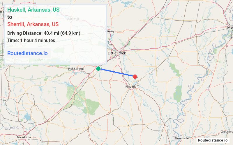
Distance from Haskell, Arkansas to Sherrill, Arkansas
The driving distance from Haskell, Arkansas to Sherrill, Arkansas is 64.5 mi (103.9 km)
The straight-line (air) distance is approximately 25.1 mi (40.4 km)
Estimated travel time by road is 1 hour 8 minutes
We found 3 routes between Haskell and Sherrill.
Available Routes
Route Directions
Take I-30 E and US-165 S to AR-15 S in England
Follow AR-15 S to Oak St in Sherrill
Route Directions
Get on I-30 E in Benton
Follow I-30 E and I-530 S/US-65 S to US-65 BUS in Pine Bluff. Take exit 35 from I-530 S/US-65 S
Follow US-65 BUS, US-79 BUS N and AR-31 N to Oak St in Sherrill
Route Directions
Continue on Grand Ave to AR-35 S
Follow AR-35 S and US-270 E to Jefferson Pkwy in Pine Bluff
Continue on Jefferson Pkwy. Take Dierk Mill Rd to US-79 BUS N/University Dr
Journey Details
Traveling from Haskell, Arkansas to Sherrill, Arkansas covers 59 miles (95 km) in a east direction. This mixed highways and local roads, moderate route typically takes 1 hour 20 minutes under normal conditions.
Drivers have 3 route options between these locations (59-80 miles / 95-129 km). The primary route shown here saves no time compared to alternatives.
The route features scenic views. During night weekday travel, expect minimal traffic congestion with average speeds around 41 mph (66 km/h) .
Journey Waypoints
Haskell
Starting Point
Sherrill
Destination
Route Map Image