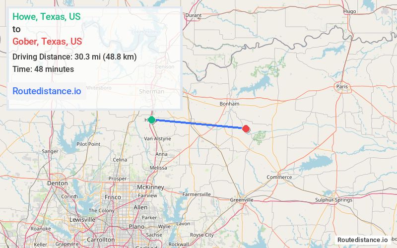
Distance from Howe, Texas to Gober, Texas
The driving distance from Howe, Texas to Gober, Texas is 39.8 mi (64 km)
The straight-line (air) distance is approximately 18.8 mi (30.3 km)
Estimated travel time by road is 44 minutes
We found 3 routes between Howe and Gober.
Available Routes
Route Directions
Follow FM 902 E, TX-11 E and State Hwy 160 S to FM814 E in Trenton
Follow FM814 E to State Hwy 121 N in Fannin County
Continue on State Hwy 121 N. Take TX-11 E to FM1553
Follow FM 68 E to County Rd 3755
Route Directions
Continue on FM 121 E to State Hwy 160 N/Pettit Pkwy
Take TX-11 E to FM1553 in Fannin County
Follow FM1553 and FM 68 E to County Rd 3755
Route Directions
Follow FM 902 E and TX-11 E to FM1553 in Fannin County
Follow FM 68 E to County Rd 3755
Journey Details
Traveling from Howe, Texas to Gober, Texas covers 33.1 miles (53 km) in a east direction. This mixed highways and local roads, moderate route typically takes 37 minutes under normal conditions.
Drivers have 3 route options between these locations (33-40 miles / 53-65 km). The primary route shown here saves 11 minutes compared to alternatives.
Journey Waypoints
Howe
Starting Point
Gober
Destination
Route Map Image