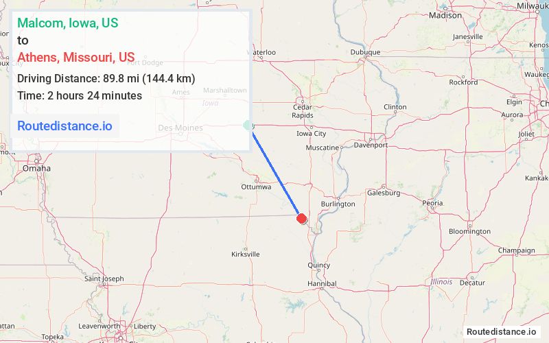
Distance from Malcom, Iowa to Athens, Missouri
The driving distance from Malcom, Iowa to Athens, Missouri is 143 mi (230.1 km)
The straight-line (air) distance is approximately 55.8 mi (89.8 km)
Estimated travel time by road is 2 hours 13 minutes
We found 3 routes between Malcom and Athens.
Available Routes
Route Directions
Follow I-80 E and IA-27 S/US-218 S/Ave of the Saints to 160th St in Lee County
Continue on 160th St. Take Co Hwy W 46 to State Hwy CC in Grant Township
Route Directions
Follow I-80 E and IA-21 to 160th Ave in Hedrick
Get on US-34 E in Wapello County from Agency Hedrick Rd
Continue on US-34 E to IA-16 E. Take exit 199 from US-34 E
Continue on IA-1 S. Take IA-2 E to State Hwy CC in Grant Township
Drive to State Hwy CC
Route Directions
Continue on US-63 S. Take Barnes City Rd, Urbana Ave, IA-23 S, IA-149 S, ... and IA-2 E to State Hwy CC in Grant Township
Drive to State Hwy CC
Journey Details
Traveling from Malcom, Iowa to Athens, Missouri covers 121.4 miles (195 km) in a southeast direction. This mixed highways and local roads, substantial route typically takes 2 hours 16 minutes under normal conditions.
Drivers have 3 route options between these locations (121-143 miles / 195-230 km). The primary route shown here saves no time compared to alternatives.
The route features scenic views. During morning weekday travel, expect morning rush hour with average speeds around 55 mph (89 km/h) .
Journey Waypoints
Malcom
Starting Point
Athens
Destination
Route Map Image