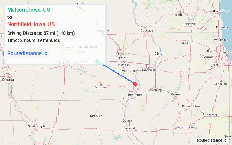
Distance from Malcom, Iowa to Northfield, Iowa
The driving distance from Malcom, Iowa to Northfield, Iowa is 116.3 mi (187.2 km)
The straight-line (air) distance is approximately 54 mi (87 km)
Estimated travel time by road is 1 hour 51 minutes
We found 3 routes between Malcom and Northfield.
Available Routes
Route Directions
Get on I-80 E from US-63 S
Continue to Tiffin. Take exit 239 from I-80 E
Follow IA-27 S/US-218 S/Ave of the Saints and IA-78 E to 260th St in Des Moines County
Route Directions
Follow I-80 E and IA-21 to 160th Ave in Hedrick
Get on US-34 E in Wapello County from Agency Hedrick Rd
Continue on US-34 E to Henry County
Continue on 170th St to IA-78 E
Drive to 260th St in Des Moines County
Route Directions
Get on I-80 E from US-63 S
Follow I-80 E and IA-27 S/US-218 S to IA-22 E in Washington County. Take exit 80 from IA-27 S/US-218 S
Continue on IA-22 E. Take Independence Ave and US-61 S to 260th St in Des Moines County
Journey Details
Traveling from Malcom, Iowa to Northfield, Iowa covers 116 miles (187 km) in a southeast direction. This highway, substantial route typically takes 1 hour 59 minutes under normal conditions.
Drivers have 3 route options between these locations (116-137 miles / 187-221 km). The primary route shown here saves 26 minutes compared to alternatives.
The route features scenic views. During midday weekday travel, expect lighter midday traffic with average speeds around 60 mph (97 km/h) .
Journey Waypoints
Malcom
Starting Point
Northfield
Destination
Route Map Image