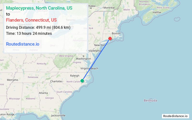
Distance from Maplecypress, North Carolina to Flanders, Connecticut
The driving distance from Maplecypress, North Carolina to Flanders, Connecticut is 640.3 mi (1030.5 km)
The straight-line (air) distance is approximately 310.6 mi (499.9 km)
Estimated travel time by road is 9 hours 57 minutes
This route includes Toll roads along the way.
We found 3 routes between Maplecypress and Flanders.
Available Routes
Route Directions
Take NC-118 W, E Hanrahan Rd and NC-11 N to NC Hwy 11 BYP in Ayden
Take NC-33 W, US-64 W, I-95 N, Baltimore-Washington Pkwy, ... and I-95 N to CT-161 N/Flanders Rd in East Lyme. Exit from I-95 N
Continue on CT-161 N/Flanders Rd to your destination
Route Directions
Take NC-118 W, E Hanrahan Rd and NC-11 N to NC Hwy 11 BYP in Ayden
Take US-64 W, I-95 N and I-270 N to US-15 N in Frederick
Continue to Camp Hill. Take the PA-581 E exit from US-15 N
Follow I-81 N, I-78 E and I-95 N to CT-161 N/Flanders Rd in East Lyme. Exit from I-95 N
Continue on CT-161 N/Flanders Rd to your destination
Route Directions
Take NC-118 E, Beaver Dam Rd and Wilmar Rd to US-17 N
Continue on US-17 N. Take US-13 N, US-17 N, US-13 N, US-113 N, ... and I-95 N to Upper Pattagansett Rd in East Lyme
Drive to your destination
Journey Details
Traveling from Maplecypress, North Carolina to Flanders, Connecticut covers 625.7 miles (1007 km) in a northeast direction. This highway, long-distance route typically takes 10 hours 33 minutes under normal conditions.
Drivers have 3 route options between these locations (626-697 miles / 1007-1122 km). The primary route shown here saves 23 minutes compared to alternatives.
The route features scenic views, toll sections. During evening weekday travel, expect evening rush hour with average speeds around 56 mph (90 km/h) .
Journey Waypoints
Maplecypress
Starting Point
Flanders
Destination
Route Map Image