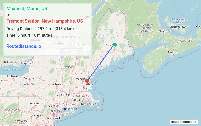
Distance from Maxfield, Maine to Fremont Station, New Hampshire
The driving distance from Maxfield, Maine to Fremont Station, New Hampshire is 243.6 mi (392 km)
The straight-line (air) distance is approximately 123 mi (197.9 km)
Estimated travel time by road is 4 hours 32 minutes
We found 2 routes between Maxfield and Fremont Station.
Available Routes
Route Directions
Get on I-95 S in Howland
Follow I-95 S to ME-3 E in Augusta. Take exit 113 from I-95 S
Get on I-295 S in Gardiner from Augusta Byp, State Rte 9 W and US-201 S
Follow I-295 S to US-1 S in Scarborough
Get on I-95 S in York from US-1 S
Continue on I-95 S. Take NH-33 W and NH-101 W/State Rte 101 W to Depot Rd in Epping. Take exit 6 from NH-101 W/State Rte 101 W
Take Beede Hill Rd to NH-107 S/Main St in Fremont
Route Directions
Get on I-95 S in Howland
Follow I-95 S, I-295 S and I-95 S to Depot Rd in Epping. Take exit 6 from State Rte 101 W
Take Beede Hill Rd to NH-107 S/Main St in Fremont
Journey Details
Traveling from Maxfield, Maine to Fremont Station, New Hampshire covers 243 miles (391 km) in a southwest direction. This fast highway, long-distance route typically takes 3 hours 35 minutes under normal conditions.
Drivers have 2 route options between these locations (243-244 miles / 391-392 km). The primary route shown here saves 57 minutes compared to alternatives.
The route features toll sections. During midday weekday travel, expect lighter midday traffic with average speeds around 75 mph (121 km/h) .
Journey Waypoints
Maxfield
Starting Point
Fremont Station
Destination
Route Map Image