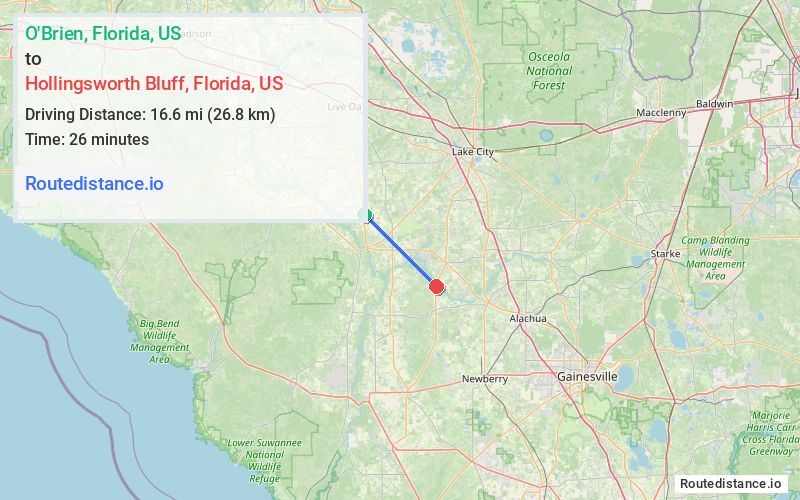
Distance from O'Brien, Florida to Hollingsworth Bluff, Florida
The driving distance from O'Brien, Florida to Hollingsworth Bluff, Florida is 24.2 mi (39 km)
The straight-line (air) distance is approximately 10.3 mi (16.6 km)
Estimated travel time by road is 29 minutes
We found 3 routes between O'Brien and Hollingsworth Bluff.
Available Routes
Route Directions
Follow US-129 S to State Hwy 138/NW Co Rd 138 in Gilchrist County
Continue on Hollinsworth St. Drive to SW Meridian Court,
Route Directions
Take 216th St, Co Rd 137 and US-27 S to Hollinsworth St in Columbia County
Continue on Hollinsworth St. Drive to SW Meridian Court,
Route Directions
Journey Details
Traveling from O'Brien, Florida to Hollingsworth Bluff, Florida covers 23.6 miles (38 km) in a southeast direction. This mixed highways and local roads, moderate route typically takes 28 minutes under normal conditions.
Drivers have 3 route options between these locations (24-27 miles / 38-44 km). The primary route shown here saves 5 minutes compared to alternatives.
The route features scenic views. During night weekday travel, expect minimal traffic congestion with average speeds around 51 mph (82 km/h) .
Journey Waypoints
O'Brien
Starting Point
Hollingsworth Bluff
Destination
Route Map Image