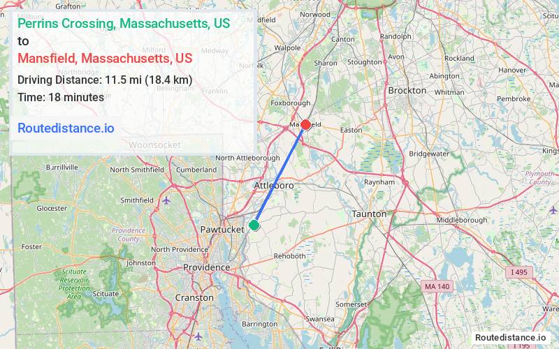
Distance from Perrins Crossing, Massachusetts to Mansfield, Massachusetts
The driving distance from Perrins Crossing, Massachusetts to Mansfield, Massachusetts is 15.8 mi (25.5 km)
The straight-line (air) distance is approximately 7.1 mi (11.5 km)
Estimated travel time by road is 22 minutes
We found 3 routes between Perrins Crossing and Mansfield.
Available Routes
Route Directions
Get on I-95 N in Attleboro from Pine St, Central Ave, Benefit St and Newport Ave
Follow I-95 N to MA-140 S in Foxborough. Take exit 13A from I-95 N
Continue on MA-140 S to your destination in Mansfield
Route Directions
Take I-95 N, MA-152 N and West St to N Main St in Mansfield
Continue on N Main St to your destination
Route Directions
Take Woodland Ave, Tremont St and Steere St to Pike Ave in Attleboro
Drive from Richardson Ave, Elm St and School St to Mansfield
Journey Details
Traveling from Perrins Crossing, Massachusetts to Mansfield, Massachusetts covers 15 miles (24 km) in a northeast direction. This secondary roads, moderate route typically takes 29 minutes under normal conditions.
Drivers have 3 route options between these locations (15-16 miles / 24-25 km). The primary route shown here saves no time compared to alternatives.
Journey Waypoints
Perrins Crossing
Starting Point
Mansfield
Destination
Route Map Image