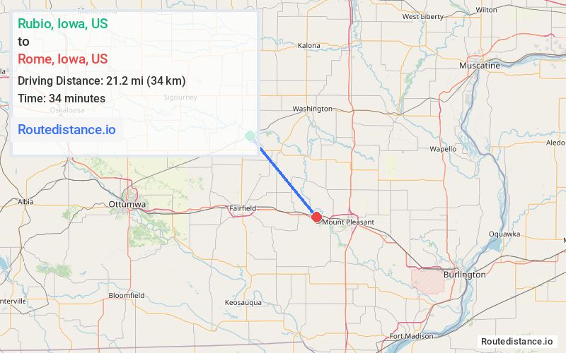
Distance from Rubio, Iowa to Rome, Iowa
The driving distance from Rubio, Iowa to Rome, Iowa is 33.9 mi (54.6 km)
The straight-line (air) distance is approximately 13.1 mi (21.2 km)
Estimated travel time by road is 39 minutes
We found 3 routes between Rubio and Rome.
Available Routes
Route Directions
Take Co Hwy G67 to IA-1 S/IA-78 W
Follow IA-1 S to US-34 BUS E/W Burlington Ave in Fairfield
Get on US-34 E
Take Old Hwy 34 to 3rd St in Rome
Route Directions
Take IA-78 E, Franklin Ave and Old Hwy 34 to Clayton Ave in Henry County
Drive to 3rd St in Rome
Route Directions
Take Co Hwy G67, IA-1 N/IA-78 E, Germanville Rd, Vetch Blvd and US-34 E to Clayton Ave in Henry County
Drive to 3rd St in Rome
Journey Details
Traveling from Rubio, Iowa to Rome, Iowa covers 29.1 miles (47 km) in a southeast direction. This mixed highways and local roads, moderate route typically takes 36 minutes under normal conditions.
Drivers have 3 route options between these locations (29-36 miles / 47-57 km). The primary route shown here saves 7 minutes compared to alternatives.
The route features scenic views. During morning weekday travel, expect morning rush hour with average speeds around 50 mph (80 km/h) .
Journey Waypoints
Rubio
Starting Point
Rome
Destination
Route Map Image