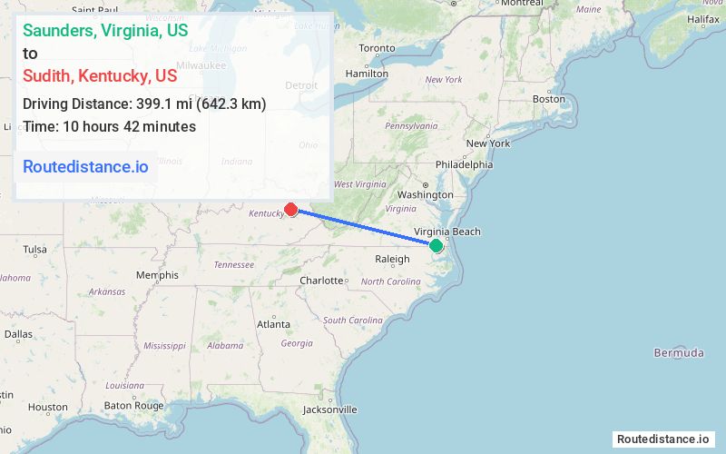
Distance from Saunders, Virginia to Sudith, Kentucky
The driving distance from Saunders, Virginia to Sudith, Kentucky is 539.9 mi (868.9 km)
The straight-line (air) distance is approximately 248 mi (399.1 km)
Estimated travel time by road is 8 hours 47 minutes
We found 3 routes between Saunders and Sudith.
Available Routes
Route Directions
Get on US-13 N from Hosier Rd, Meadow Country Rd and Carolina Rd
Follow US-13 N to Pruden Blvd. Take the exit toward US-460/Petersburg/Downtown/Suffolk from US-13 N
Get on I-95 N in Petersburg from US-460 W
Continue on I-95 N. Take I-64 W, I-81 S, I-64 W, I-77 N and I-64 W to KY-801 S in Rowan County. Take exit 133 from I-64 W
Take US-60 W and KY-211 to KY-36 E in Menifee County
Route Directions
Get on US-13 N from Hosier Rd, Meadow Country Rd and Carolina Rd
Follow US-13 N to Pruden Blvd. Take the exit toward US-460/Petersburg/Downtown/Suffolk from US-13 N
Get on I-95 N in Petersburg from US-460 W
Follow I-95 N and I-85 S to US-460 W in Dinwiddie County. Take exit 61 from I-85 S/US-460 W
Get on I-81 S in Daleville
Continue to Christiansburg. Exit from I-81 S
Get on I-77 N in Mercer County
Follow I-77 N and I-64 W to KY-801 S in Rowan County. Take exit 133 from I-64 W
Take US-60 W and KY-211 to KY-36 E in Menifee County
Route Directions
Get on US-13 N from Hosier Rd, Meadow Country Rd and Carolina Rd
Follow US-13 N to Pruden Blvd. Take the exit toward US-460/Petersburg/Downtown/Suffolk from US-13 N
Get on I-95 N in Petersburg from US-460 W
Take I-64 W to KY-801 S in Rowan County. Take exit 133 from I-64 W
Take US-60 W and KY-211 to KY-36 E in Menifee County
Journey Details
Traveling from Saunders, Virginia to Sudith, Kentucky covers 538.9 miles (867 km) in a west direction. This fast highway, long-distance route typically takes 8 hours 31 minutes under normal conditions.
Drivers have 3 route options between these locations (539-544 miles / 867-875 km). The primary route shown here saves 39 minutes compared to alternatives.
The route features toll sections. During evening weekday travel, expect evening rush hour with average speeds around 66 mph (106 km/h) .
Journey Waypoints
Saunders
Starting Point
Sudith
Destination
Route Map Image