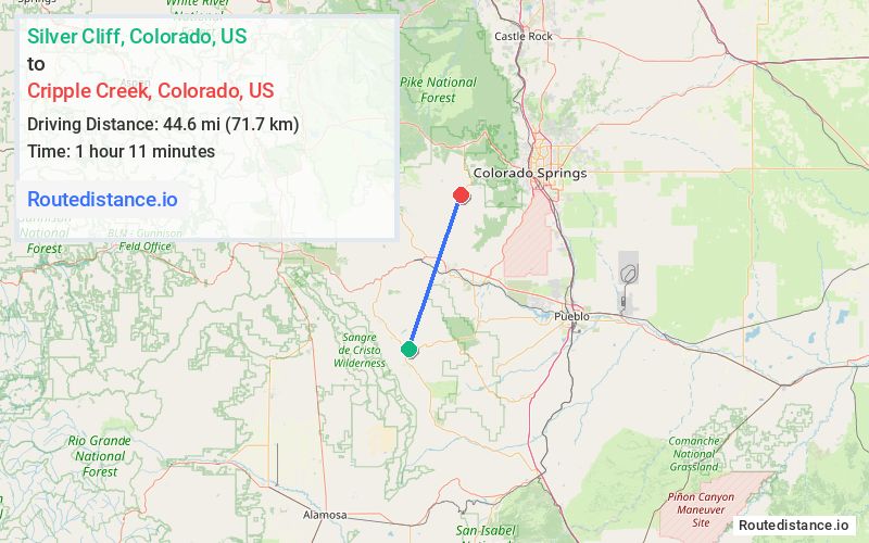
Distance from Silver Cliff, Colorado to Cripple Creek, Colorado
The driving distance from Silver Cliff, Colorado to Cripple Creek, Colorado is 81.3 mi (130.8 km)
The straight-line (air) distance is approximately 27.7 mi (44.6 km)
Estimated travel time by road is 1 hour 40 minutes
We found 3 routes between Silver Cliff and Cripple Creek.
Available Routes
Route Directions
Take CO-69 N and US-50 E to High Park Rd in Fremont County
Continue on High Park Rd. Take Teller County Rd 1 to W Bennett Ave in Cripple Creek
Route Directions
Take CO-96 E, CO-67 N, CO-115 N, US-50 W and CO-9 N to High Park Rd in Fremont County
Continue on High Park Rd. Take Teller County Rd 1 to W Bennett Ave in Cripple Creek
Route Directions
Take CO-96 E and CO-67 N to N Raynolds Ave in Cañon City
Take Field Ave, Co Rd 9 and Shelf Rd to CO-67 N in Cripple Creek
Journey Details
Traveling from Silver Cliff, Colorado to Cripple Creek, Colorado covers 71.4 miles (115 km) in a northeast direction. This secondary roads, substantial route typically takes 2 hours 3 minutes under normal conditions.
Drivers have 3 route options between these locations (71-94 miles / 115-151 km). The primary route shown here saves no time compared to alternatives.
The route features scenic views. During midday weekend travel, expect typical weekend traffic patterns with average speeds around 37 mph (60 km/h) .
Journey Waypoints
Silver Cliff
Starting Point
Cripple Creek
Destination
Route Map Image