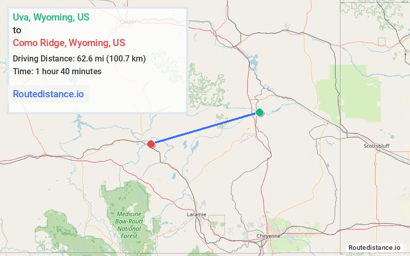
Distance from Uva, Wyoming to Como Ridge, Wyoming
The driving distance from Uva, Wyoming to Como Ridge, Wyoming is 135.2 mi (217.5 km)
The straight-line (air) distance is approximately 38.9 mi (62.6 km)
Estimated travel time by road is 2 hours 15 minutes
We found 3 routes between Uva and Como Ridge.
Available Routes
Route Directions
Get on I-25 S/US-87 S from WY-320 S
Take WY-34 W and US-287 N to 32 Mile Rd/Little Medicine Rd in Carbon County
Route Directions
Get on I-25 N/US-26 W/US-87 N from WY-320 N
Follow I-25 N to US-20 W/US-26 in Casper. Take exit 189 from I-25 N
Take WY-487 S to 32 Mile Rd/Little Medicine Rd in Carbon County
Route Directions
Follow E Laramie River Rd to WY-320 N
Continue on WY-320 N. Take I-25 N/US-26 W/US-87 N and Cold Springs Rd to 32 Mile Rd/Little Medicine Rd in Carbon County
Journey Details
Traveling from Uva, Wyoming to Como Ridge, Wyoming covers 116.2 miles (187 km) in a west direction. This secondary roads, substantial route typically takes 2 hours 46 minutes under normal conditions.
Drivers have 3 route options between these locations (116-177 miles / 187-285 km). The primary route shown here saves no time compared to alternatives.
Journey Waypoints
Uva
Starting Point
Como Ridge
Destination
Route Map Image