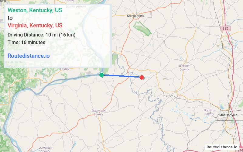
Distance from Weston, Kentucky to Virginia, Kentucky
The driving distance from Weston, Kentucky to Virginia, Kentucky is 18.5 mi (29.8 km)
The straight-line (air) distance is approximately 6.2 mi (10 km)
Estimated travel time by road is 28 minutes
We found 2 routes between Weston and Virginia.
Available Routes
Route Directions
Take Bells Mine Rd/Bells Mines Ch-Green Chapel Rd and Rudolph Chandler Rd to KY-365 N
Continue on KY-365 N. Take US-60 W to Granny Hill Rd in Webster County
Drive to Virginia Mine
Route Directions
Take Baker Hollow Rd to KY-365 S
Take US-60 E to Granny Hill Rd in Webster County
Drive to Virginia Mine
Journey Details
Traveling from Weston, Kentucky to Virginia, Kentucky covers 17.4 miles (28 km) in a east direction. This mixed highways and local roads, moderate route typically takes 25 minutes under normal conditions.
Drivers have 2 route options between these locations (17-19 miles / 28-30 km). The primary route shown here saves 3 minutes compared to alternatives.
The route features scenic views. During evening weekday travel, expect evening rush hour with average speeds around 45 mph (72 km/h) .
Journey Waypoints
Weston
Starting Point
Virginia
Destination
Route Map Image