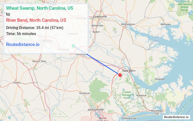
Distance from Wheat Swamp, North Carolina to River Bend, North Carolina
The driving distance from Wheat Swamp, North Carolina to River Bend, North Carolina is 43.3 mi (69.7 km)
The straight-line (air) distance is approximately 22 mi (35.4 km)
Estimated travel time by road is 52 minutes
We found 3 routes between Wheat Swamp and River Bend.
Available Routes
Route Directions
Take US-70 E, Wyse Fork Rd and 10 Mile Fork Rd to Eastchurch Rd/Shoreline Dr in River Bend
Route Directions
Follow Grays Mill Rd to NC-58 S in Greene County
Continue on NC-58 S. Take NC-55 E to Seth West Rd in Lenoir County
Take British Rd and Tilghman Rd to US-70 E in Jones County
Follow US-70 E to Tuscarora Rhems Rd in Craven County. Take the SR 1224 exit from US-70 E
Continue on Tuscarora Rhems Rd. Drive to Shoreline Dr in River Bend
Route Directions
Take US-70 E to Tuscarora Rhems Rd in Craven County. Take the SR 1224 exit from US-70 E
Continue on Tuscarora Rhems Rd. Drive to Shoreline Dr in River Bend
Journey Details
Traveling from Wheat Swamp, North Carolina to River Bend, North Carolina covers 42.8 miles (69 km) in a southeast direction. This mixed highways and local roads, moderate route typically takes 47 minutes under normal conditions.
Drivers have 3 route options between these locations (43-48 miles / 69-77 km). The primary route shown here saves 5 minutes compared to alternatives.
Journey Waypoints
Wheat Swamp
Starting Point
River Bend
Destination
Route Map Image