Distance to and from Alexandria, New Hampshire
Alexandria, NH
Alexandria
New Hampshire
US
America/New_York
Location Information
-
Full AddressAlexandria, NH
-
Coordinates43.6114624, -71.7928579
-
LocationAlexandria , New Hampshire , US
-
TimezoneAmerica/New_York
-
Current Local Time4:28:21 PM America/New_YorkSaturday, May 3, 2025
-
Website
-
Page Views0
Directions to Nearest Cities
About Alexandria
Alexandria is a town in Grafton County, New Hampshire, United States. The population was 1,776 at the 2020 census, up from 1,613 at the 2010 census. Newfound Lake is in the northeast corner, with Wellington State Park on the western shore. The town is home to Welton Falls State Forest.


Nearby Places
Found 10 places within 50 miles

Bristol
3.1 mi
5.0 km
Bristol, NH 03222
Get directions

New Hampton
8.2 mi
13.2 km
New Hampton, NH
Get directions

Ashland
9.9 mi
15.9 km
Ashland, NH
Get directions

Plymouth
11.3 mi
18.2 km
Plymouth, NH 03264
Get directions

Andover
12.2 mi
19.6 km
Andover, NH
Get directions

Holderness
13.2 mi
21.2 km
Holderness, NH
Get directions

Sanbornton
13.5 mi
21.7 km
Sanbornton, NH
Get directions

Franklin
13.7 mi
22.0 km
Franklin, NH
Get directions

Canaan
13.8 mi
22.2 km
Canaan, NH 03741
Get directions

Meredith
15.0 mi
24.1 km
Meredith, NH
Get directions
Bristol
3.1 mi
5.0 km
Bristol, NH 03222
New Hampton
8.2 mi
13.2 km
New Hampton, NH
Ashland
9.9 mi
15.9 km
Ashland, NH
Plymouth
11.3 mi
18.2 km
Plymouth, NH 03264
Andover
12.2 mi
19.6 km
Andover, NH
Holderness
13.2 mi
21.2 km
Holderness, NH
Sanbornton
13.5 mi
21.7 km
Sanbornton, NH
Franklin
13.7 mi
22.0 km
Franklin, NH
Canaan
13.8 mi
22.2 km
Canaan, NH 03741
Meredith
15.0 mi
24.1 km
Meredith, NH
Location Links
Local Weather
Weather Information
Coming soon!
Location Map
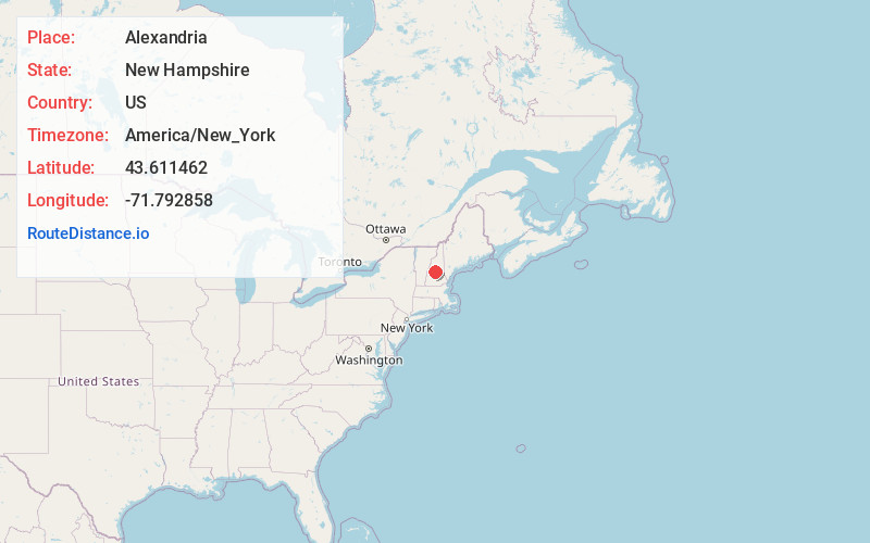
Static map view of Alexandria, New Hampshire
Browse Places by Distance
Places within specific distances from Alexandria
Short Distances
Long Distances
Click any distance to see all places within that range from Alexandria. Distances shown in miles (1 mile ≈ 1.61 kilometers).