Distance to Auburn, New Hampshire

Calculating Your Route
Just a moment while we process your request...
Location Information
-
Full AddressAuburn, NH
-
Coordinates43.0045288, -71.348398
-
LocationAuburn , New Hampshire , US
-
TimezoneAmerica/New_York
-
Current Local Time6:38:43 PM America/New_YorkWednesday, June 18, 2025
-
Website
-
Page Views0
About Auburn
Auburn is a town in Rockingham County, New Hampshire, United States. The population was 5,946 at the 2020 census, up from 4,953 at the 2010 census.


Nearby Places
Found 10 places within 50 miles

Hooksett
5.3 mi
8.5 km
Hooksett, NH
Get directions

Manchester
5.4 mi
8.7 km
Manchester, NH
Get directions

Derry
8.6 mi
13.8 km
Derry, NH 03038
Get directions

Raymond
8.6 mi
13.8 km
Raymond, NH
Get directions

Bedford
9.3 mi
15.0 km
Bedford, NH
Get directions

Sandown
9.7 mi
15.6 km
Sandown, NH 03873
Get directions

Londonderry
10.9 mi
17.5 km
Londonderry, NH
Get directions

Merrimack
12.0 mi
19.3 km
Merrimack, NH
Get directions

Hampstead
12.3 mi
19.8 km
Hampstead, NH
Get directions

Goffstown
12.8 mi
20.6 km
Goffstown, NH
Get directions
Location Links
Local Weather
Weather Information
Coming soon!
Location Map
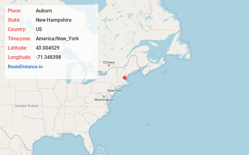
Static map view of Auburn, New Hampshire
Browse Places by Distance
Places within specific distances from Auburn
Short Distances
Long Distances
Click any distance to see all places within that range from Auburn. Distances shown in miles (1 mile ≈ 1.61 kilometers).