Distance to Barkhamsted, Connecticut

Calculating Your Route
Just a moment while we process your request...
Location Information
-
Full AddressBarkhamsted, CT
-
Coordinates41.9292629, -72.9139904
-
LocationBarkhamsted , Connecticut , US
-
TimezoneAmerica/New_York
-
Current Local Time5:37:10 AM America/New_YorkWednesday, June 18, 2025
-
Page Views0
About Barkhamsted
Barkhamsted is a town in Litchfield County, Connecticut, United States. It contains seven villages: West Hill, Mallory, Barkhamsted Center, Center Hill, Washington Hill, Pleasant Valley, and Riverton. The population was 3,647 at the 2020 census, down from 3,799 at the 2010 census.


Nearby Places
Found 10 places within 50 miles

New Hartford
4.7 mi
7.6 km
New Hartford, CT
Get directions

Hartland
4.8 mi
7.7 km
Hartland, CT
Get directions
Puddle Town
4.9 mi
7.9 km
Puddle Town, New Hartford, CT 06057
Get directions
Firetown
5.0 mi
8.0 km
Firetown, Simsbury, CT 06070
Get directions
Pegville
6.3 mi
10.1 km
Pegville, Granby, CT 06035
Get directions
Mechanicsville
6.8 mi
10.9 km
Mechanicsville, Granby, CT 06035
Get directions

Simsbury
6.9 mi
11.1 km
Simsbury, CT
Get directions
Robertsville
7.5 mi
12.1 km
Robertsville, Colebrook, CT 06065
Get directions

Avon
9.3 mi
15.0 km
Avon, CT
Get directions
Camp Spruce Hill
9.7 mi
15.6 km
Camp Spruce Hill, Tolland, MA 01034
Get directions
Location Links
Local Weather
Weather Information
Coming soon!
Location Map
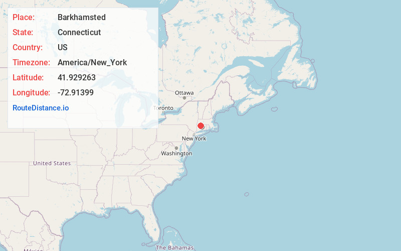
Static map view of Barkhamsted, Connecticut
Browse Places by Distance
Places within specific distances from Barkhamsted
Short Distances
Long Distances
Click any distance to see all places within that range from Barkhamsted. Distances shown in miles (1 mile ≈ 1.61 kilometers).