Distance to Bowie, Louisiana

Calculating Your Route
Just a moment while we process your request...
Location Information
-
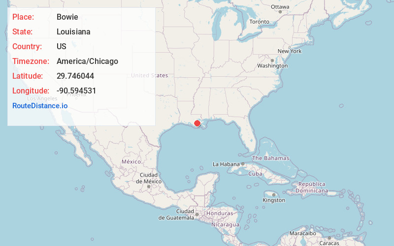
Full AddressBowie, LA 70394
-
Coordinates29.7460437, -90.5945313
-
LocationLouisiana , US
-
TimezoneAmerica/Chicago
-
Current Local Time3:36:58 AM America/ChicagoWednesday, May 21, 2025
-
Page Views0
Nearby Places
Found 10 places within 50 miles

Raceland
1.3 mi
2.1 km
Raceland, LA 70394
Get directions

Godchaux
1.3 mi
2.1 km
Godchaux, Raceland, LA 70394
Get directions
Lewistown
1.4 mi
2.3 km
Lewistown, Raceland, LA 70394
Get directions
Mathews
5.0 mi
8.0 km
Mathews, LA
Get directions
Clotilda
6.2 mi
10.0 km
Clotilda, LA 70374
Get directions

Lockport
7.7 mi
12.4 km
Lockport, LA 70374
Get directions
Rousseau
7.8 mi
12.6 km
Rousseau, LA 70301
Get directions
Choctaw
8.7 mi
14.0 km
Choctaw, LA 70301
Get directions

Des Allemands
9.0 mi
14.5 km
Des Allemands, LA 70030
Get directions

Gheens
9.2 mi
14.8 km
Gheens, LA 70355
Get directions
Location Links
Local Weather
Weather Information
Coming soon!
Location Map
Static map view of Bowie, Louisiana
Browse Places by Distance
Places within specific distances from Bowie
Short Distances
Long Distances
Click any distance to see all places within that range from Bowie. Distances shown in miles (1 mile ≈ 1.61 kilometers).