Distance to Cedar Crossing, Georgia

Calculating Your Route
Just a moment while we process your request...
Location Information
-
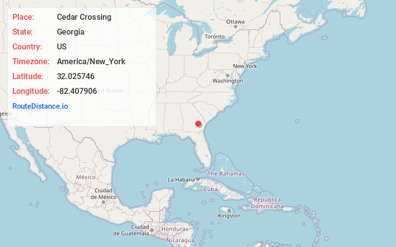
Full AddressCedar Crossing, GA 30473
-
Coordinates32.0257464, -82.4079056
-
LocationCedar Crossing , Georgia , US
-
TimezoneAmerica/New_York
-
Current Local Time1:07:50 AM America/New_YorkSunday, June 22, 2025
-
Page Views0


Nearby Places
Found 10 places within 50 miles

Toombs Central
3.8 mi
6.1 km
Toombs Central, GA 30436
Get directions
English Eddy
4.9 mi
7.9 km
English Eddy, GA 30473
Get directions

Alston
5.6 mi
9.0 km
Alston, GA
Get directions

Uvalda
5.9 mi
9.5 km
Uvalda, GA 30473
Get directions
South Thompson
6.1 mi
9.8 km
South Thompson, GA 30474
Get directions
Falling Rocks
6.3 mi
10.1 km
Falling Rocks, GA 31513
Get directions
Charlotteville
6.8 mi
10.9 km
Charlotteville, GA 30473
Get directions
Center
7.1 mi
11.4 km
Center, GA 30474
Get directions
Long Pond
8.9 mi
14.3 km
Long Pond, GA 30445
Get directions
Petross
9.1 mi
14.6 km
Petross, GA 30474
Get directions
Location Links
Local Weather
Weather Information
Coming soon!
Location Map
Static map view of Cedar Crossing, Georgia
Browse Places by Distance
Places within specific distances from Cedar Crossing
Short Distances
Long Distances
Click any distance to see all places within that range from Cedar Crossing. Distances shown in miles (1 mile ≈ 1.61 kilometers).