Distance to Chillicothe, Ohio

Calculating Your Route
Just a moment while we process your request...
Location Information
-
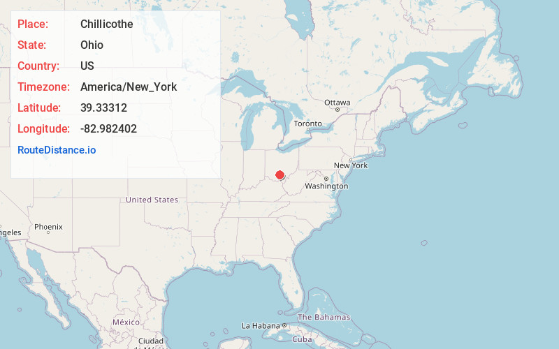
Full AddressChillicothe, OH 45601
-
Coordinates39.3331197, -82.9824019
-
LocationChillicothe , Ohio , US
-
TimezoneAmerica/New_York
-
Current Local Time3:16:49 PM America/New_YorkTuesday, June 3, 2025
-
Website
-
Page Views0
About Chillicothe
Chillicothe is a city in Ross County, Ohio, United States, and its county seat. The population was 22,059 at the 2020 census. Located along the Scioto River 45 miles south of Columbus, Chillicothe was the first and third capital of Ohio.


Nearby Places
Found 9 places within 50 miles

Lancaster
33.2 mi
53.4 km
Lancaster, OH 43130
Get directions

Grove City
38.4 mi
61.8 km
Grove City, OH
Get directions

Pickerington
40.0 mi
64.4 km
Pickerington, OH
Get directions

Columbus
43.5 mi
70.0 km
Columbus, OH
Get directions

Reynoldsburg
43.9 mi
70.7 km
Reynoldsburg, OH
Get directions

Athens
47.1 mi
75.8 km
Athens, OH 45701
Get directions

Gahanna
47.7 mi
76.8 km
Gahanna, OH
Get directions

Upper Arlington
48.0 mi
77.2 km
Upper Arlington, OH
Get directions

Hilliard
49.3 mi
79.3 km
Hilliard, OH
Get directions
Location Links
Local Weather
Weather Information
Coming soon!
Location Map
Static map view of Chillicothe, Ohio
Browse Places by Distance
Places within specific distances from Chillicothe
Short Distances
Long Distances
Click any distance to see all places within that range from Chillicothe. Distances shown in miles (1 mile ≈ 1.61 kilometers).