Distance to Clawson, Michigan

Calculating Your Route
Just a moment while we process your request...
Location Information
-
Full AddressClawson, MI
-
Coordinates42.5333682, -83.1463166
-
LocationClawson , Michigan , US
-
TimezoneAmerica/Detroit
-
Current Local Time5:21:01 PM America/DetroitWednesday, July 2, 2025
-
Website
-
Page Views0
About Clawson
Clawson is a city in Oakland County in the U.S. state of Michigan. A northern suburb of Detroit, Clawson is located about 19 miles north of downtown Detroit. As of the 2020 census, the city had a population of 11,389.


Nearby Places
Found 10 places within 50 miles

Berkley
2.8 mi
4.5 km
Berkley, MI
Get directions

Royal Oak
3.0 mi
4.8 km
Royal Oak, MI
Get directions

Birmingham
3.4 mi
5.5 km
Birmingham, MI
Get directions

Madison Heights
3.9 mi
6.3 km
Madison Heights, MI 48071
Get directions

Troy
5.1 mi
8.2 km
Troy, MI
Get directions

Ferndale
5.1 mi
8.2 km
Ferndale, MI 48220
Get directions

Hazel Park
5.3 mi
8.5 km
Hazel Park, MI 48030
Get directions

Oak Park
5.4 mi
8.7 km
Oak Park, MI 48237
Get directions

Southfield
5.7 mi
9.2 km
Southfield, MI
Get directions

Sterling Heights
6.7 mi
10.8 km
Sterling Heights, MI
Get directions
Location Links
Local Weather
Weather Information
Coming soon!
Location Map
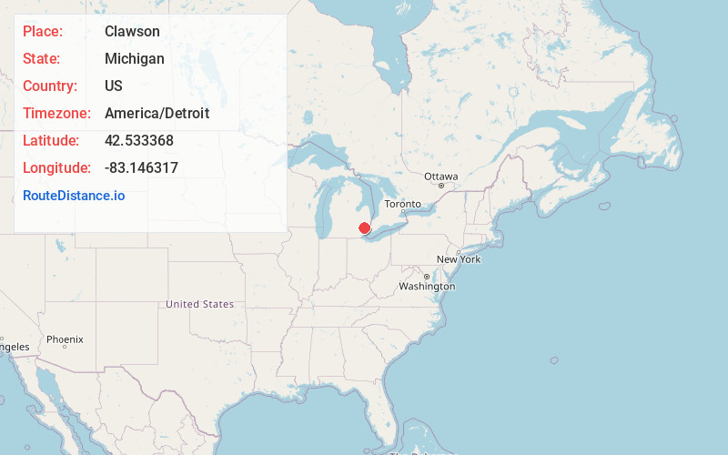
Static map view of Clawson, Michigan
Browse Places by Distance
Places within specific distances from Clawson
Short Distances
Long Distances
Click any distance to see all places within that range from Clawson. Distances shown in miles (1 mile ≈ 1.61 kilometers).