Distance to Cleveland, Arkansas

Calculating Your Route
Just a moment while we process your request...
Location Information
-
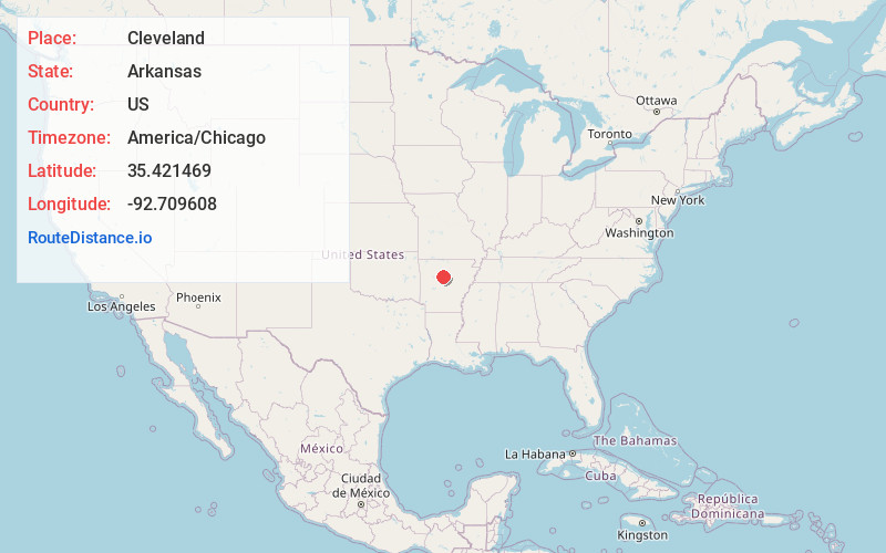
Full AddressCleveland, AR 72030
-
Coordinates35.4214685, -92.7096079
-
LocationCleveland , Arkansas , US
-
TimezoneAmerica/Chicago
-
Current Local Time10:58:00 AM America/ChicagoSunday, June 1, 2025
-
Page Views0
About Cleveland
Cleveland is an unincorporated community in Conway County, Arkansas, United States. Cleveland is located on Arkansas Highway 95, 19 miles north of Morrilton. Cleveland has a post office with ZIP code 72030. Cleveland was founded in 1890, named after former President Grover Cleveland.


Nearby Places
Found 10 places within 50 miles

Gobblers Point
3.9 mi
6.3 km
Gobblers Point, AR 72080
Get directions
Sunnyside Creek
3.9 mi
6.3 km
Sunnyside Creek, Arkansas 72027
Get directions
Robertsville
5.9 mi
9.5 km
Robertsville, AR 72063
Get directions
Lanty
6.0 mi
9.7 km
Lanty, AR 72063
Get directions

Jerusalem
6.1 mi
9.8 km
Jerusalem, AR 72080
Get directions
Wonderview
6.6 mi
10.6 km
Wonderview, AR 72063
Get directions
Claude
7.0 mi
11.3 km
Claude, AR 72030
Get directions
Lone Grove
7.4 mi
11.9 km
Lone Grove, AR 72156
Get directions
Stumptoe
7.4 mi
11.9 km
Stumptoe, AR 72080
Get directions
St Vincent
8.4 mi
13.5 km
St Vincent, AR 72063
Get directions
Location Links
Local Weather
Weather Information
Coming soon!
Location Map
Static map view of Cleveland, Arkansas
Browse Places by Distance
Places within specific distances from Cleveland
Short Distances
Long Distances
Click any distance to see all places within that range from Cleveland. Distances shown in miles (1 mile ≈ 1.61 kilometers).