Distance to Cullman, Alabama

Calculating Your Route
Just a moment while we process your request...
Location Information
-
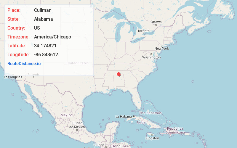
Full AddressCullman, AL
-
Coordinates34.1748208, -86.8436124
-
LocationCullman , Alabama , US
-
TimezoneAmerica/Chicago
-
Current Local Time2:52:14 AM America/ChicagoFriday, June 13, 2025
-
Page Views0
About Cullman
Cullman is the largest city and county seat of Cullman County, Alabama, United States. It is located along Interstate 65, about 50 miles north of Birmingham and about 55 miles south of Huntsville. As of the 2020 census it had a population of 18,213, with an estimated population of 19,913 in 2023.


Nearby Places
Found 10 places within 50 miles

Decatur
30.8 mi
49.6 km
Decatur, AL
Get directions

Madison
36.6 mi
58.9 km
Madison, AL
Get directions

Albertville
36.8 mi
59.2 km
Albertville, AL
Get directions

Trussville
40.6 mi
65.3 km
Trussville, AL
Get directions

Huntsville
41.1 mi
66.1 km
Huntsville, AL
Get directions

Athens
44.0 mi
70.8 km
Athens, AL
Get directions

Birmingham
45.4 mi
73.1 km
Birmingham, AL
Get directions

Mountain Brook
46.9 mi
75.5 km
Mountain Brook, AL
Get directions

Homewood
48.6 mi
78.2 km
Homewood, AL
Get directions

Gadsden
49.2 mi
79.2 km
Gadsden, AL
Get directions
Location Links
Local Weather
Weather Information
Coming soon!
Location Map
Static map view of Cullman, Alabama
Browse Places by Distance
Places within specific distances from Cullman
Short Distances
Long Distances
Click any distance to see all places within that range from Cullman. Distances shown in miles (1 mile ≈ 1.61 kilometers).