Distance to Dexter, Missouri

Calculating Your Route
Just a moment while we process your request...
Location Information
-
Full AddressDexter, MO 63841
-
Coordinates36.7958866, -89.9578688
-
LocationDexter , Missouri , US
-
TimezoneAmerica/Chicago
-
Current Local Time7:57:23 PM America/ChicagoWednesday, June 18, 2025
-
Page Views0
About Dexter
Dexter is a city in Stoddard County, Missouri, United States, founded in 1873. The population was 7,864 at the 2010 census.


Nearby Places
Found 5 places within 50 miles

Sikeston
21.2 mi
34.1 km
Sikeston, MO 63801
Get directions

Poplar Bluff
24.2 mi
38.9 km
Poplar Bluff, MO 63901
Get directions

Kennett
39.1 mi
62.9 km
Kennett, MO 63857
Get directions

Cape Girardeau
42.8 mi
68.9 km
Cape Girardeau, MO
Get directions

Jackson
43.6 mi
70.2 km
Jackson, MO 63755
Get directions
Location Links
Local Weather
Weather Information
Coming soon!
Location Map
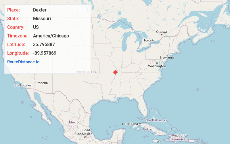
Static map view of Dexter, Missouri
Browse Places by Distance
Places within specific distances from Dexter
Short Distances
Long Distances
Click any distance to see all places within that range from Dexter. Distances shown in miles (1 mile ≈ 1.61 kilometers).