Distance to Dover, Ohio

Calculating Your Route
Just a moment while we process your request...
Location Information
-
Full AddressDover, OH
-
Coordinates40.5206198, -81.4740054
-
LocationDover , Ohio , US
-
TimezoneAmerica/New_York
-
Current Local Time6:07:41 AM America/New_YorkWednesday, June 18, 2025
-
Website
-
Page Views0
About Dover
Dover is a city in Tuscarawas County, Ohio, United States, along the Tuscarawas River. The population was 13,112 at the 2020 census. It is a principal city of the New Philadelphia–Dover micropolitan area, approximately 68 miles south of Cleveland and borders the city of New Philadelphia.


Nearby Places
Found 10 places within 50 miles

New Philadelphia
2.6 mi
4.2 km
New Philadelphia, OH 44663
Get directions

Massillon
19.2 mi
30.9 km
Massillon, OH
Get directions

Canton
19.8 mi
31.9 km
Canton, OH
Get directions

North Canton
24.8 mi
39.9 km
North Canton, OH
Get directions

New Franklin
29.3 mi
47.2 km
New Franklin, OH
Get directions

Green
29.4 mi
47.3 km
Green, OH
Get directions

Wooster
31.1 mi
50.1 km
Wooster, OH 44691
Get directions

Alliance
33.4 mi
53.8 km
Alliance, OH 44601
Get directions

Barberton
34.7 mi
55.8 km
Barberton, OH 44203
Get directions

Wadsworth
37.4 mi
60.2 km
Wadsworth, OH 44281
Get directions
Location Links
Local Weather
Weather Information
Coming soon!
Location Map
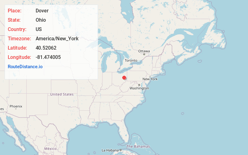
Static map view of Dover, Ohio
Browse Places by Distance
Places within specific distances from Dover
Short Distances
Long Distances
Click any distance to see all places within that range from Dover. Distances shown in miles (1 mile ≈ 1.61 kilometers).