Distance to Fernandina Beach, Florida

Calculating Your Route
Just a moment while we process your request...
Location Information
-
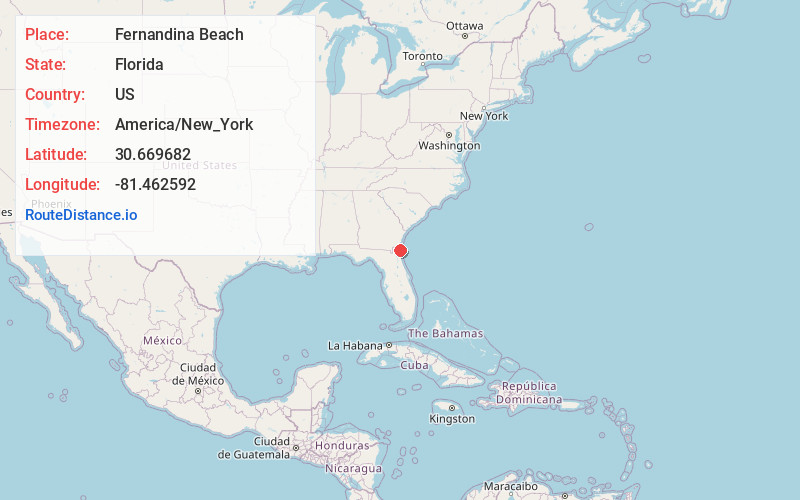
Full AddressFernandina Beach, FL 32034
-
Coordinates30.6696818, -81.4625919
-
LocationFernandina Beach , Florida , US
-
TimezoneAmerica/New_York
-
Current Local Time12:51:14 AM America/New_YorkWednesday, June 18, 2025
-
Website
-
Page Views0
About Fernandina Beach
Fernandina Beach is a city in northeastern Florida and the county seat of Nassau County, Florida, United States. It is the northernmost city on Florida's Atlantic coast, situated on Amelia Island, and is one of the municipalities comprising Greater Jacksonville.


Nearby Places
Found 10 places within 50 miles

Old Fernandina
1.5 mi
2.4 km
Old Fernandina, Fernandina Beach, FL 32034
Get directions

Amelia Island
3.0 mi
4.8 km
Amelia Island, Florida 32034
Get directions
Chester
4.7 mi
7.6 km
Chester, Yulee, FL 32097
Get directions
O'Neil
4.8 mi
7.7 km
O'Neil, FL 32034
Get directions
Point Peter
5.0 mi
8.0 km
Point Peter, St Marys, GA 31558
Get directions

Dungeness Ruins
5.5 mi
8.9 km
Dungeness Ruins, St Marys, GA 31558
Get directions
Amelia City
5.5 mi
8.9 km
Amelia City, FL 32034
Get directions

American Beach
6.7 mi
10.8 km
American Beach, FL 32034
Get directions
Franklintown
7.9 mi
12.7 km
Franklintown, FL 32034
Get directions

St Marys
8.4 mi
13.5 km
St Marys, GA
Get directions
Location Links
Local Weather
Weather Information
Coming soon!
Location Map
Static map view of Fernandina Beach, Florida
Browse Places by Distance
Places within specific distances from Fernandina Beach
Short Distances
Long Distances
Click any distance to see all places within that range from Fernandina Beach. Distances shown in miles (1 mile ≈ 1.61 kilometers).