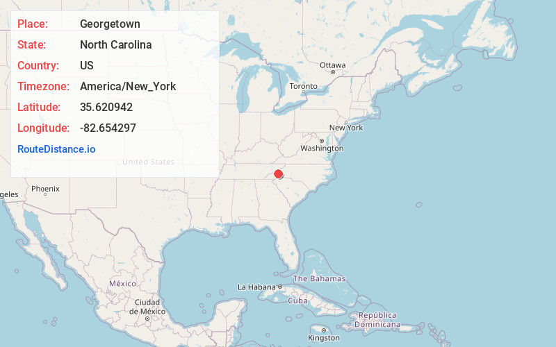
Distance to Georgetown, North Carolina

Calculating Your Route
Just a moment while we process your request...
Location Information
-
Full AddressGeorgetown, NC 28806
-
Coordinates35.6209422, -82.6542968
-
LocationNorth Carolina , US
-
TimezoneAmerica/New_York
-
Current Local Time5:20:03 AM America/New_YorkWednesday, June 18, 2025
-
Page Views0
Nearby Places
Found 10 places within 50 miles

Emma
3.9 mi
6.3 km
Emma, NC 28806
Get directions

Woodfin
4.1 mi
6.6 km
Woodfin, NC
Get directions

Asheville
6.3 mi
10.1 km
Asheville, NC
Get directions

Weaverville
7.4 mi
11.9 km
Weaverville, NC
Get directions

Bent Creek
8.2 mi
13.2 km
Bent Creek, NC 28806
Get directions
Beaverdam
8.7 mi
14.0 km
Beaverdam, NC 28715
Get directions

Biltmore Forest
9.3 mi
15.0 km
Biltmore Forest, NC 28803
Get directions
Avery Creek
11.6 mi
18.7 km
Avery Creek, NC 28704
Get directions

Canton
12.0 mi
19.3 km
Canton, NC
Get directions

Marshall
12.3 mi
19.8 km
Marshall, NC 28753
Get directions
Location Links
Local Weather
Weather Information
Coming soon!
Location Map
Static map view of Georgetown, North Carolina
Browse Places by Distance
Places within specific distances from Georgetown
Short Distances
Long Distances
Click any distance to see all places within that range from Georgetown. Distances shown in miles (1 mile ≈ 1.61 kilometers).