Distance to Gladstone, Missouri

Calculating Your Route
Just a moment while we process your request...
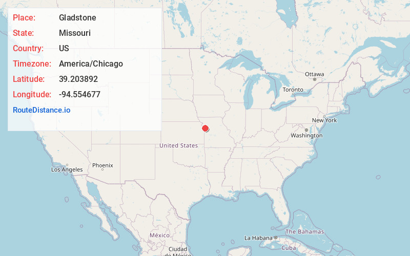
Location Information
-
Full AddressGladstone, MO
-
Coordinates39.2038918, -94.554677
-
LocationGladstone , Missouri , US
-
TimezoneAmerica/Chicago
-
Current Local Time11:40:22 AM America/ChicagoWednesday, June 18, 2025
-
Page Views0
About Gladstone
Gladstone is a city in Clay County, Missouri, United States and a suburb of Kansas City. The City of Gladstone is located about 10–20 minutes from downtown Kansas City, and about 10–20 minutes from Kansas City International Airport. As of the 2020 census, the city population was 27,063.


Nearby Places
Found 10 places within 50 miles

Kansas City
7.2 mi
11.6 km
Kansas City, KS
Get directions

Kansas City
7.3 mi
11.7 km
Kansas City, MO
Get directions

Liberty
7.8 mi
12.6 km
Liberty, MO
Get directions

Independence
10.8 mi
17.4 km
Independence, MO
Get directions

Raytown
14.4 mi
23.2 km
Raytown, MO
Get directions

Shawnee
15.2 mi
24.5 km
Shawnee, KS
Get directions

Overland Park
16.5 mi
26.6 km
Overland Park, KS
Get directions

Leawood
16.7 mi
26.9 km
Leawood, KS
Get directions

Blue Springs
19.5 mi
31.4 km
Blue Springs, MO
Get directions

Lenexa
19.8 mi
31.9 km
Lenexa, KS
Get directions
Location Links
Local Weather
Weather Information
Coming soon!
Location Map
Static map view of Gladstone, Missouri
Browse Places by Distance
Places within specific distances from Gladstone
Short Distances
Long Distances
Click any distance to see all places within that range from Gladstone. Distances shown in miles (1 mile ≈ 1.61 kilometers).