Distance to Harleysville, Pennsylvania

Calculating Your Route
Just a moment while we process your request...
Location Information
-
Full AddressHarleysville, PA 19438
-
Coordinates40.2795476, -75.3871206
-
LocationHarleysville , Pennsylvania , US
-
TimezoneAmerica/New_York
-
Current Local Time7:59:48 AM America/New_YorkTuesday, July 1, 2025
-
Page Views0
About Harleysville
Harleysville is a census-designated place in Montgomery County, Pennsylvania, United States. It is a suburb of Philadelphia. The population was 9,286 at the 2010 census. It is located mostly within Lower Salford Township and also in Franconia Township.


Nearby Places
Found 10 places within 50 miles

Lower Salford Township
1.5 mi
2.4 km
Lower Salford Township, PA
Get directions

Franconia Township
3.0 mi
4.8 km
Franconia Township, PA
Get directions

Montgomery County
3.5 mi
5.6 km
Montgomery County, PA
Get directions

Towamencin Township
3.6 mi
5.8 km
Towamencin Township, PA
Get directions

Skippack
4.0 mi
6.4 km
Skippack, PA
Get directions

Hatfield
4.6 mi
7.4 km
Hatfield, PA 19440
Get directions

Lansdale
6.0 mi
9.7 km
Lansdale, PA 19446
Get directions

Worcester Township
6.2 mi
10.0 km
Worcester Township, PA
Get directions
Upper Gwynedd Township
6.6 mi
10.6 km
Upper Gwynedd Township, PA
Get directions

Montgomeryville
7.9 mi
12.7 km
Montgomeryville, PA
Get directions
Location Links
Local Weather
Weather Information
Coming soon!
Location Map
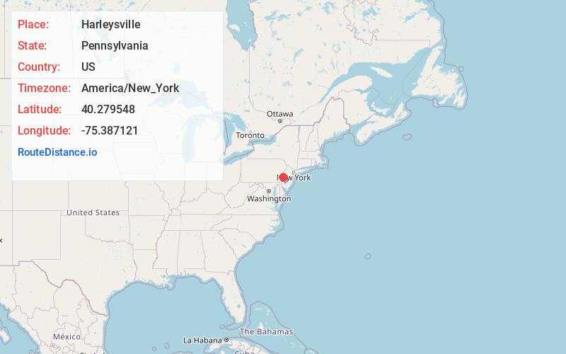
Static map view of Harleysville, Pennsylvania
Browse Places by Distance
Places within specific distances from Harleysville
Short Distances
Long Distances
Click any distance to see all places within that range from Harleysville. Distances shown in miles (1 mile ≈ 1.61 kilometers).