Distance to Hazlehurst, Mississippi

Calculating Your Route
Just a moment while we process your request...
Location Information
-
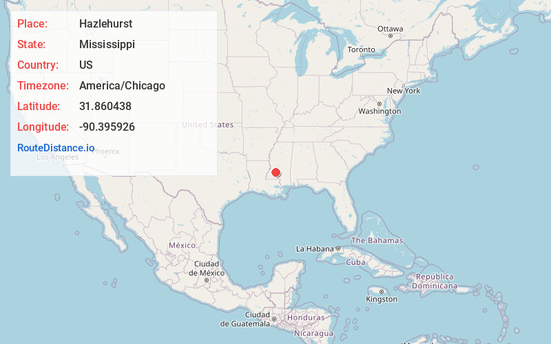
Full AddressHazlehurst, MS 39083
-
Coordinates31.8604382, -90.3959255
-
LocationHazlehurst , Mississippi , US
-
TimezoneAmerica/Chicago
-
Current Local Time10:49:01 AM America/ChicagoFriday, June 20, 2025
-
Page Views0
About Hazlehurst
Hazlehurst is a city in and the county seat of Copiah County, Mississippi, United States, located about 30 miles south of the state capital Jackson along Interstate 55. The population was 4,009 at the 2010 census. It is part of the Jackson Metropolitan Statistical Area.


Nearby Places
Found 10 places within 50 miles

Crystal Springs
9.1 mi
14.6 km
Crystal Springs, MS 39059
Get directions

Brookhaven
19.6 mi
31.5 km
Brookhaven, MS
Get directions

Byram
23.7 mi
38.1 km
Byram, MS
Get directions

Florence
25.8 mi
41.5 km
Florence, MS
Get directions

Richland
29.5 mi
47.5 km
Richland, MS
Get directions

Pearl
32.0 mi
51.5 km
Pearl, MS
Get directions

Jackson
32.8 mi
52.8 km
Jackson, MS
Get directions

Clinton
33.5 mi
53.9 km
Clinton, MS
Get directions

Brandon
37.0 mi
59.5 km
Brandon, MS
Get directions

Flowood
37.5 mi
60.4 km
Flowood, MS
Get directions
Location Links
Local Weather
Weather Information
Coming soon!
Location Map
Static map view of Hazlehurst, Mississippi
Browse Places by Distance
Places within specific distances from Hazlehurst
Short Distances
Long Distances
Click any distance to see all places within that range from Hazlehurst. Distances shown in miles (1 mile ≈ 1.61 kilometers).