Distance to Henagar, Alabama

Calculating Your Route
Just a moment while we process your request...
Location Information
-
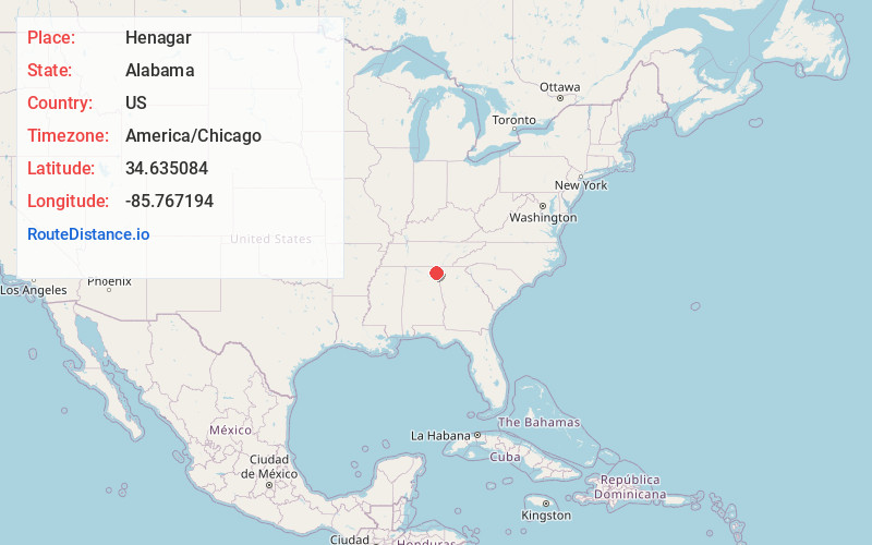
Full AddressHenagar, AL
-
Coordinates34.635084, -85.7671936
-
LocationHenagar , Alabama , US
-
TimezoneAmerica/Chicago
-
Current Local Time9:49:33 PM America/ChicagoSaturday, June 7, 2025
-
Page Views0
About Henagar
Henagar is a city in DeKalb County, Alabama, United States. At the 2020 census, the population was 2,292.
Henagar is located on top of Sand Mountain, a southern extension of the Cumberland Plateau.


Nearby Places
Found 10 places within 50 miles

Rainsville
10.8 mi
17.4 km
Rainsville, AL
Get directions

Fort Payne
13.5 mi
21.7 km
Fort Payne, AL
Get directions

Scottsboro
15.4 mi
24.8 km
Scottsboro, AL
Get directions

Summerville
26.1 mi
42.0 km
Summerville, GA 30747
Get directions

South Pittsburg
26.3 mi
42.3 km
South Pittsburg, TN 37380
Get directions

LaFayette
28.0 mi
45.1 km
LaFayette, GA 30728
Get directions

Jasper
31.4 mi
50.5 km
Jasper, TN 37347
Get directions

Chickamauga
31.6 mi
50.9 km
Chickamauga, GA 30707
Get directions

Centre
33.8 mi
54.4 km
Centre, AL 35960
Get directions

Guntersville
35.6 mi
57.3 km
Guntersville, AL
Get directions
Location Links
Local Weather
Weather Information
Coming soon!
Location Map
Static map view of Henagar, Alabama
Browse Places by Distance
Places within specific distances from Henagar
Short Distances
Long Distances
Click any distance to see all places within that range from Henagar. Distances shown in miles (1 mile ≈ 1.61 kilometers).