Distance to and from Hill Top, Maryland
Hill Top, MD 20646
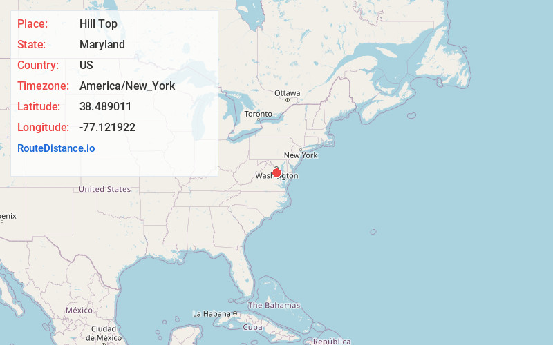
Maryland
US
America/New_York
Location Information
-
Full AddressHill Top, MD 20646
-
Coordinates38.4890108, -77.1219217
-
LocationMaryland , US
-
TimezoneAmerica/New_York
-
Current Local Time9:52:33 AM America/New_YorkMonday, May 5, 2025
-
Page Views0
Directions to Nearest Cities
About Hill Top
Hill Top, Maryland, is a rural community in Charles County, 2.4 km west-northwest of Welcome and 3.2 km east-southeast of Ironsides, on Hilltop Road, a loop off of Maryland Route 6, and about 7 miles west of Port Tobacco.
Nearby Places
Found 10 places within 50 miles

Potomac Shores
5.6 mi
9.0 km
Potomac Shores, MD 20677
Get directions
Port Tobacco
5.8 mi
9.3 km
Port Tobacco, MD
Get directions
Pomfret
7.6 mi
12.2 km
Pomfret, MD
Get directions

Indian Head
8.0 mi
12.9 km
Indian Head, MD 20640
Get directions
Potomac Heights
8.2 mi
13.2 km
Potomac Heights, MD 20640
Get directions

La Plata
8.4 mi
13.5 km
La Plata, MD 20646
Get directions
Pomonkey
8.7 mi
14.0 km
Pomonkey, Bryans Road, MD 20646
Get directions

Quantico
9.4 mi
15.1 km
Quantico, VA 22134
Get directions
Cherry Hill
9.6 mi
15.4 km
Cherry Hill, VA 22026
Get directions

Bryans Road
9.9 mi
15.9 km
Bryans Road, MD
Get directions
Potomac Shores
5.6 mi
9.0 km
Potomac Shores, MD 20677
Port Tobacco
5.8 mi
9.3 km
Port Tobacco, MD
Pomfret
7.6 mi
12.2 km
Pomfret, MD
Indian Head
8.0 mi
12.9 km
Indian Head, MD 20640
Potomac Heights
8.2 mi
13.2 km
Potomac Heights, MD 20640
La Plata
8.4 mi
13.5 km
La Plata, MD 20646
Pomonkey
8.7 mi
14.0 km
Pomonkey, Bryans Road, MD 20646
Quantico
9.4 mi
15.1 km
Quantico, VA 22134
Cherry Hill
9.6 mi
15.4 km
Cherry Hill, VA 22026
Bryans Road
9.9 mi
15.9 km
Bryans Road, MD
Location Links
Local Weather
Weather Information
Coming soon!
Location Map
Static map view of Hill Top, Maryland
Browse Places by Distance
Places within specific distances from Hill Top
Short Distances
Long Distances
Click any distance to see all places within that range from Hill Top. Distances shown in miles (1 mile ≈ 1.61 kilometers).