Distance to Holly Grove, Arkansas

Calculating Your Route
Just a moment while we process your request...
Location Information
-
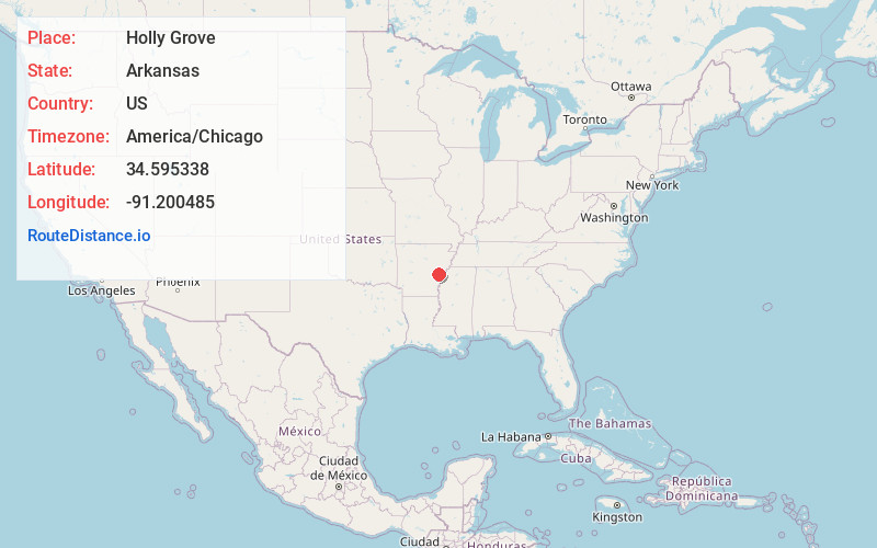
Full AddressHolly Grove, AR 72069
-
Coordinates34.5953381, -91.2004849
-
LocationHolly Grove , Arkansas , US
-
TimezoneAmerica/Chicago
-
Current Local Time1:04:06 AM America/ChicagoThursday, June 19, 2025
-
Page Views0
About Holly Grove
Holly Grove is a city in Monroe County, Arkansas, United States. As of the 2020 census, the city population was 460, down from 602 in 2010.
The town started as a plantation community which was a suburb of Lawrenceville, which was the seat of Monroe County until 1857.


Nearby Places
Found 10 places within 50 miles

Clarendon
9.1 mi
14.6 km
Clarendon, AR
Get directions

Marvell
16.6 mi
26.7 km
Marvell, AR 72366
Get directions

Brinkley
20.2 mi
32.5 km
Brinkley, AR 72021
Get directions

Stuttgart
21.5 mi
34.6 km
Stuttgart, AR 72160
Get directions

DeWitt
22.2 mi
35.7 km
DeWitt, AR 72042
Get directions

Hazen
25.1 mi
40.4 km
Hazen, AR
Get directions

Marianna
27.3 mi
43.9 km
Marianna, AR 72360
Get directions
Palestine
31.1 mi
50.1 km
Palestine, AR 72372
Get directions

Des Arc
31.3 mi
50.4 km
Des Arc, AR 72040
Get directions

Carlisle
33.6 mi
54.1 km
Carlisle, AR 72024
Get directions
Location Links
Local Weather
Weather Information
Coming soon!
Location Map
Static map view of Holly Grove, Arkansas
Browse Places by Distance
Places within specific distances from Holly Grove
Short Distances
Long Distances
Click any distance to see all places within that range from Holly Grove. Distances shown in miles (1 mile ≈ 1.61 kilometers).