Distance to Knights Mill, Michigan

Calculating Your Route
Just a moment while we process your request...
Location Information
-
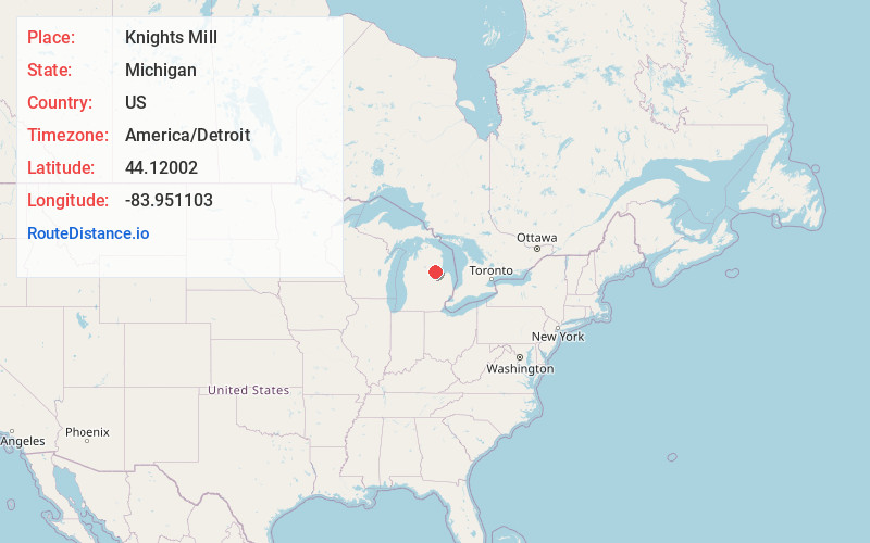
Full AddressKnights Mill, Clayton Township, MI 48659
-
Coordinates44.1200198, -83.951103
-
LocationClayton Township , Michigan , US
-
TimezoneAmerica/Detroit
-
Current Local Time4:48:23 PM America/DetroitWednesday, June 4, 2025
-
Page Views0
Nearby Places
Found 10 places within 50 miles

Prescott
5.1 mi
8.2 km
Prescott, MI 48756
Get directions

Skidway Lake
6.1 mi
9.8 km
Skidway Lake, MI
Get directions

Omer
6.9 mi
11.1 km
Omer, MI 48749
Get directions

Sterling
7.0 mi
11.3 km
Sterling, MI 48659
Get directions
Twining
7.1 mi
11.4 km
Twining, MI 48766
Get directions

Turner
8.2 mi
13.2 km
Turner, MI 48765
Get directions

Standish
9.5 mi
15.3 km
Standish, MI 48658
Get directions

Whittemore
10.7 mi
17.2 km
Whittemore, MI 48770
Get directions

Au Gres
13.6 mi
21.9 km
Au Gres, MI 48703
Get directions

Woodville
17.9 mi
28.8 km
Woodville, MI 48650
Get directions
Location Links
Local Weather
Weather Information
Coming soon!
Location Map
Static map view of Knights Mill, Michigan
Browse Places by Distance
Places within specific distances from Knights Mill
Short Distances
Long Distances
Click any distance to see all places within that range from Knights Mill. Distances shown in miles (1 mile ≈ 1.61 kilometers).