Distance to Liggett, Kentucky

Calculating Your Route
Just a moment while we process your request...
Location Information
-
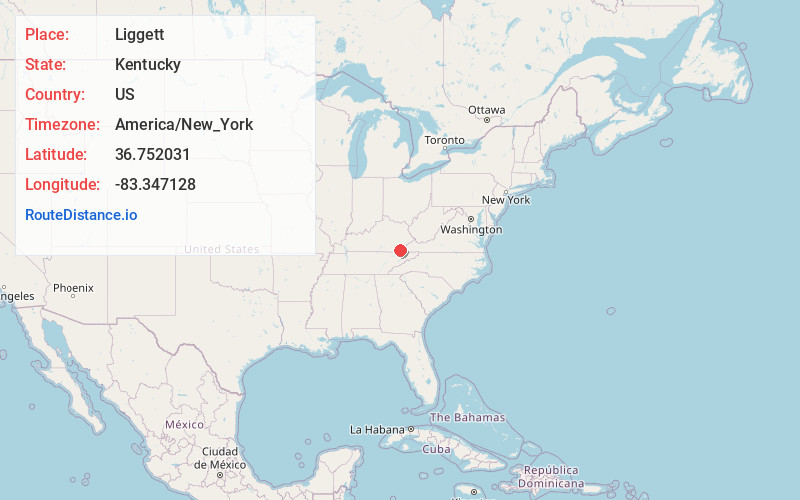
Full AddressLiggett, KY 40831
-
Coordinates36.7520313, -83.3471281
-
LocationKentucky , US
-
TimezoneAmerica/New_York
-
Current Local Time8:07:52 PM America/New_YorkSaturday, May 24, 2025
-
Page Views0
Nearby Places
Found 10 places within 50 miles

South Wallins
5.6 mi
9.0 km
South Wallins, KY 40873
Get directions
Dressen
5.7 mi
9.2 km
Dressen, KY 40831
Get directions

Rose Hill
5.7 mi
9.2 km
Rose Hill, VA 24281
Get directions
Bobs Creek
6.1 mi
9.8 km
Bobs Creek, KY 40815
Get directions

Harlan
6.4 mi
10.3 km
Harlan, KY
Get directions
Pathfork
6.5 mi
10.5 km
Pathfork, KY 40863
Get directions

Wallins Creek
6.7 mi
10.8 km
Wallins Creek, KY 40873
Get directions

Loyall
6.9 mi
11.1 km
Loyall, KY
Get directions
Cawood
6.9 mi
11.1 km
Cawood, KY 40815
Get directions
Kitts
7.7 mi
12.4 km
Kitts, KY 40831
Get directions
Location Links
Local Weather
Weather Information
Coming soon!
Location Map
Static map view of Liggett, Kentucky
Browse Places by Distance
Places within specific distances from Liggett
Short Distances
Long Distances
Click any distance to see all places within that range from Liggett. Distances shown in miles (1 mile ≈ 1.61 kilometers).