Distance to and from Masonville, New Jersey
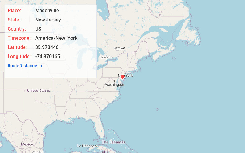
Masonville, Mt Laurel Township, NJ 08054
Mt Laurel Township
New Jersey
US
America/New_York
Location Information
-
Full AddressMasonville, Mt Laurel Township, NJ 08054
-
Coordinates39.9784457, -74.8701653
-
NeighborhoodMasonville
-
LocationMt Laurel Township , New Jersey , US
-
TimezoneAmerica/New_York
-
Current Local Time3:10:20 AM America/New_YorkSunday, May 4, 2025
-
Page Views0
Directions to Nearest Cities
About Masonville
Masonville is an unincorporated community located within Mount Laurel Township, Burlington County, in the U.S. state of New Jersey. Located east of Moorestown, the community of Masonville was developed when a highway was built in 1794. Major roads in Masonville include County Route 537 and Route 38.
Nearby Places
Found 10 places within 50 miles

Bougher
1.2 mi
1.9 km
Bougher, Mt Laurel Township, NJ 08054
Get directions
Rancocas Heights
1.2 mi
1.9 km
Rancocas Heights, Hainesport, NJ 08036
Get directions

Hainesport
2.3 mi
3.7 km
Hainesport, NJ
Get directions
Garfield Park
3.0 mi
4.8 km
Garfield Park, Willingboro, NJ 08046
Get directions
Westampton Township
3.4 mi
5.5 km
Westampton Township, NJ
Get directions

Willingboro
3.5 mi
5.6 km
Willingboro, NJ
Get directions

Lumberton Township
3.6 mi
5.8 km
Lumberton Township, NJ
Get directions
Fostertown
3.7 mi
6.0 km
Fostertown, Lumberton Township, NJ 08048
Get directions
Clermont
3.8 mi
6.1 km
Clermont, Mt Holly, NJ 08060
Get directions
Pennypacker Park
4.0 mi
6.4 km
Pennypacker Park, Willingboro, NJ 08046
Get directions
Bougher
1.2 mi
1.9 km
Bougher, Mt Laurel Township, NJ 08054
Rancocas Heights
1.2 mi
1.9 km
Rancocas Heights, Hainesport, NJ 08036
Hainesport
2.3 mi
3.7 km
Hainesport, NJ
Garfield Park
3.0 mi
4.8 km
Garfield Park, Willingboro, NJ 08046
Westampton Township
3.4 mi
5.5 km
Westampton Township, NJ
Willingboro
3.5 mi
5.6 km
Willingboro, NJ
Lumberton Township
3.6 mi
5.8 km
Lumberton Township, NJ
Fostertown
3.7 mi
6.0 km
Fostertown, Lumberton Township, NJ 08048
Clermont
3.8 mi
6.1 km
Clermont, Mt Holly, NJ 08060
Pennypacker Park
4.0 mi
6.4 km
Pennypacker Park, Willingboro, NJ 08046
Location Links
Local Weather
Weather Information
Coming soon!
Location Map
Static map view of Masonville, New Jersey
Browse Places by Distance
Places within specific distances from Masonville
Short Distances
Long Distances
Click any distance to see all places within that range from Masonville. Distances shown in miles (1 mile ≈ 1.61 kilometers).