Distance to Natural Steps, Arkansas

Calculating Your Route
Just a moment while we process your request...
Location Information
-
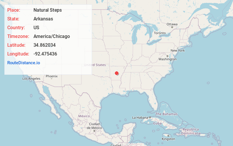
Full AddressNatural Steps, AR 72135
-
Coordinates34.8620341, -92.4754356
-
LocationNatural Steps , Arkansas , US
-
TimezoneAmerica/Chicago
-
Current Local Time3:42:19 PM America/ChicagoTuesday, May 20, 2025
-
Page Views0
About Natural Steps
Natural Steps is an unincorporated census-designated place in Pulaski County, Arkansas, United States. It is located 18 miles northwest of Little Rock along the southern bank of the Arkansas River, on Arkansas Highway 300. Per the 2020 census, the population was 413.
Nearby Places
Found 10 places within 50 miles

Roland
3.0 mi
4.8 km
Roland, AR 72135
Get directions

Maumelle
4.4 mi
7.1 km
Maumelle, AR
Get directions

Mayflower
7.1 mi
11.4 km
Mayflower, AR
Get directions

Cammack Village
9.3 mi
15.0 km
Cammack Village, AR 72207
Get directions
Avilla
13.0 mi
20.9 km
Avilla, AR
Get directions

Little Rock
13.4 mi
21.6 km
Little Rock, AR
Get directions

Conway
16.0 mi
25.7 km
Conway, AR
Get directions

Sherwood
16.3 mi
26.2 km
Sherwood, AR
Get directions

Bryant
16.5 mi
26.6 km
Bryant, AR
Get directions
McAlmont
16.6 mi
26.7 km
McAlmont, AR 72117
Get directions
Location Links
Local Weather
Weather Information
Coming soon!
Location Map
Static map view of Natural Steps, Arkansas
Browse Places by Distance
Places within specific distances from Natural Steps
Short Distances
Long Distances
Click any distance to see all places within that range from Natural Steps. Distances shown in miles (1 mile ≈ 1.61 kilometers).