Distance to Olive Branch, Louisiana

Calculating Your Route
Just a moment while we process your request...
Location Information
-
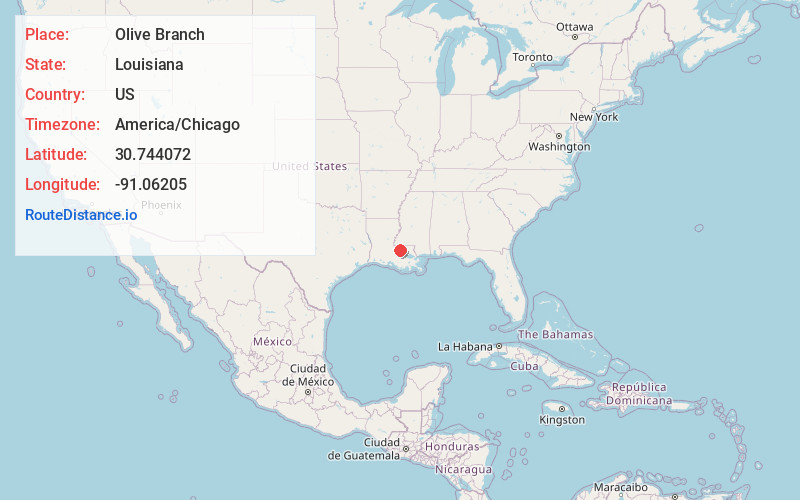
Full AddressOlive Branch, LA 70777
-
Coordinates30.7440722, -91.0620495
-
LocationLouisiana , US
-
TimezoneAmerica/Chicago
-
Current Local Time6:24:33 PM America/ChicagoThursday, June 5, 2025
-
Page Views0
Nearby Places
Found 10 places within 50 miles

Oaknolia
4.3 mi
6.9 km
Oaknolia, LA 70777
Get directions
Slaughter
5.1 mi
8.2 km
Slaughter, LA 70777
Get directions
Milldale
5.7 mi
9.2 km
Milldale, LA 70791
Get directions

Zachary
8.7 mi
14.0 km
Zachary, LA
Get directions

Clinton
8.8 mi
14.2 km
Clinton, LA 70722
Get directions

Jackson
11.3 mi
18.2 km
Jackson, LA 70748
Get directions
Baywood
11.3 mi
18.2 km
Baywood, LA 70722
Get directions
Puckett
12.2 mi
19.6 km
Puckett, Central, LA 70818
Get directions

Baker
12.5 mi
20.1 km
Baker, LA
Get directions
Wilson
12.6 mi
20.3 km
Wilson, LA 70789
Get directions
Location Links
Local Weather
Weather Information
Coming soon!
Location Map
Static map view of Olive Branch, Louisiana
Browse Places by Distance
Places within specific distances from Olive Branch
Short Distances
Long Distances
Click any distance to see all places within that range from Olive Branch. Distances shown in miles (1 mile ≈ 1.61 kilometers).