Distance to Orchard, Colorado

Calculating Your Route
Just a moment while we process your request...
Location Information
-
Full AddressOrchard, CO 80649
-
Coordinates40.3310766, -104.1180962
-
LocationOrchard , Colorado , US
-
TimezoneAmerica/Denver
-
Current Local Time5:58:08 PM America/DenverSaturday, June 21, 2025
-
Page Views0
About Orchard
Orchard is an unincorporated town, a post office, and a census-designated place located in and governed by Morgan County, Colorado, United States. The CDP is a part of the Fort Morgan, CO Micropolitan Statistical Area. The Orchard post office has the ZIP Code 80649.


Nearby Places
Found 10 places within 50 miles

Jackson Lake
3.3 mi
5.3 km
Jackson Lake, CO
Get directions

Wiggins
7.3 mi
11.7 km
Wiggins, CO 80654
Get directions

Weldona
7.9 mi
12.7 km
Weldona, CO 80653
Get directions
Morgan Heights
15.6 mi
25.1 km
Morgan Heights, CO 80701
Get directions

Log Lane Village
15.8 mi
25.4 km
Log Lane Village, CO
Get directions

Fort Morgan
17.7 mi
28.5 km
Fort Morgan, CO 80701
Get directions

Briggsdale
23.7 mi
38.1 km
Briggsdale, CO 80611
Get directions

Kersey
23.7 mi
38.1 km
Kersey, CO
Get directions

Raymer
24.0 mi
38.6 km
Raymer, CO 80742
Get directions

Keenesburg
26.2 mi
42.2 km
Keenesburg, CO 80643
Get directions
Location Links
Local Weather
Weather Information
Coming soon!
Location Map
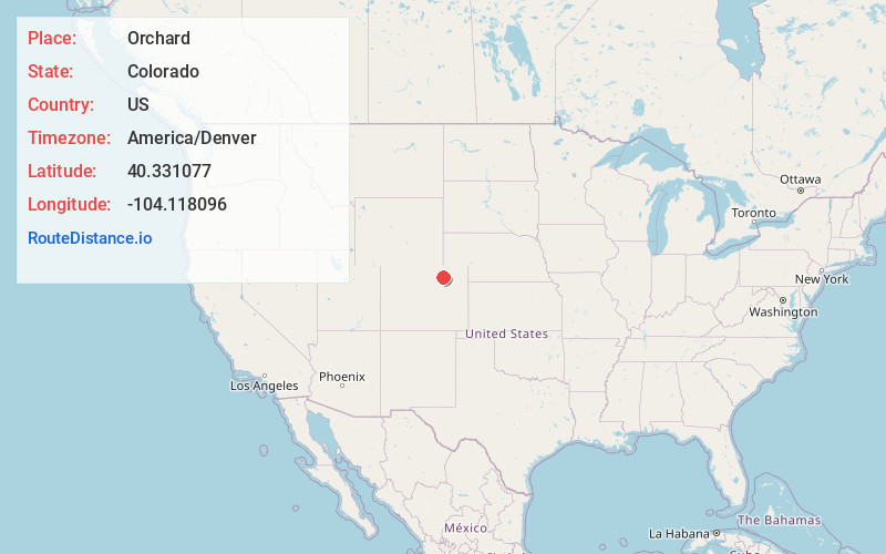
Static map view of Orchard, Colorado
Browse Places by Distance
Places within specific distances from Orchard
Short Distances
Long Distances
Click any distance to see all places within that range from Orchard. Distances shown in miles (1 mile ≈ 1.61 kilometers).