Distance to Owensboro, Georgia

Calculating Your Route
Just a moment while we process your request...
Location Information
-
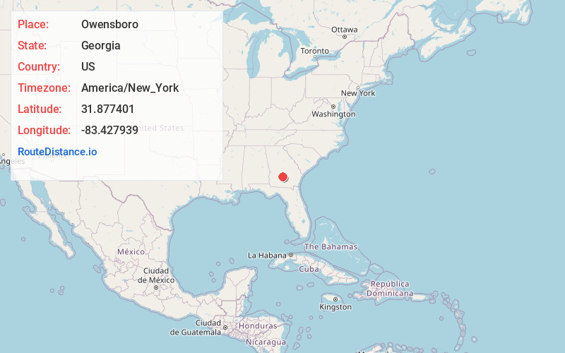
Full AddressOwensboro, GA 31079
-
Coordinates31.8774014, -83.4279393
-
LocationGeorgia , US
-
TimezoneAmerica/New_York
-
Current Local Time2:27:10 AM America/New_YorkSaturday, June 7, 2025
-
Page Views0
Nearby Places
Found 10 places within 50 miles

Rochelle
5.4 mi
8.7 km
Rochelle, GA 31079
Get directions

Kramer
5.9 mi
9.5 km
Kramer, GA 31079
Get directions

Rebecca
6.0 mi
9.7 km
Rebecca, GA 31783
Get directions
Double Run Creek
6.9 mi
11.1 km
Double Run Creek, Georgia 31783
Get directions
Sibbie
7.4 mi
11.9 km
Sibbie, GA 31001
Get directions

Pitts
8.1 mi
13.0 km
Pitts, GA 31072
Get directions
Statham Shoals
10.5 mi
16.9 km
Statham Shoals, GA 31001
Get directions

Abbeville
10.6 mi
17.1 km
Abbeville, GA 31001
Get directions
Hatley
11.0 mi
17.7 km
Hatley, GA 31015
Get directions
Lands Crossroads
11.2 mi
18.0 km
Lands Crossroads, GA 31783
Get directions
Location Links
Local Weather
Weather Information
Coming soon!
Location Map
Static map view of Owensboro, Georgia
Browse Places by Distance
Places within specific distances from Owensboro
Short Distances
Long Distances
Click any distance to see all places within that range from Owensboro. Distances shown in miles (1 mile ≈ 1.61 kilometers).