Distance to Pedlar Mills, Virginia

Calculating Your Route
Just a moment while we process your request...
Location Information
-
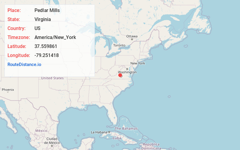
Full AddressPedlar Mills, VA 24574
-
Coordinates37.5598607, -79.2514183
-
LocationVirginia , US
-
TimezoneAmerica/New_York
-
Current Local Time11:02:11 AM America/New_YorkSaturday, June 14, 2025
-
Page Views0
Nearby Places
Found 10 places within 50 miles

Abert
4.5 mi
7.2 km
Abert, VA 24503
Get directions
Big Island
6.2 mi
10.0 km
Big Island, VA
Get directions
Winesap
7.7 mi
12.4 km
Winesap, VA 24574
Get directions
Monroe
7.9 mi
12.7 km
Monroe, VA 24574
Get directions
Coffee
9.4 mi
15.1 km
Coffee, VA 24503
Get directions
Monitor
10.0 mi
16.1 km
Monitor, VA 24521
Get directions

Amherst
11.1 mi
17.9 km
Amherst, VA 24521
Get directions

Madison Heights
11.3 mi
18.2 km
Madison Heights, VA 24572
Get directions

Lynchburg
11.7 mi
18.8 km
Lynchburg, VA
Get directions

Glasgow
12.0 mi
19.3 km
Glasgow, VA 24555
Get directions
Location Links
Local Weather
Weather Information
Coming soon!
Location Map
Static map view of Pedlar Mills, Virginia
Browse Places by Distance
Places within specific distances from Pedlar Mills
Short Distances
Long Distances
Click any distance to see all places within that range from Pedlar Mills. Distances shown in miles (1 mile ≈ 1.61 kilometers).