Distance to Pep, New Mexico

Calculating Your Route
Just a moment while we process your request...
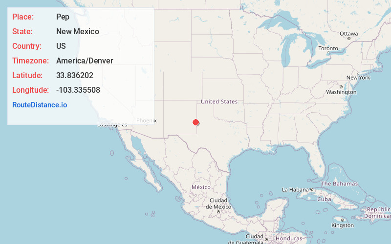
Location Information
-
Full AddressPep, NM 88126
-
Coordinates33.836202, -103.3355078
-
LocationPep , New Mexico , US
-
TimezoneAmerica/Denver
-
Current Local Time4:40:12 PM America/DenverFriday, June 20, 2025
-
Page Views0
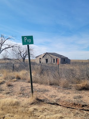
About Pep
Pep is an unincorporated community in southern Roosevelt County, in the southeastern part of the U.S. state of New Mexico. The community is composed almost entirely of farms and cattle ranches and is located approximately seven miles south of Dora on New Mexico State Road 206. The ZIP Code for Pep is 88126.


Nearby Places
Found 10 places within 50 miles

Richland
4.1 mi
6.6 km
Richland, NM 88132
Get directions
Garrison
7.1 mi
11.4 km
Garrison, NM 88132
Get directions
Bledsoe
23.5 mi
37.8 km
Bledsoe, TX
Get directions

Portales
24.2 mi
38.9 km
Portales, NM 88130
Get directions

Morton
34.0 mi
54.7 km
Morton, TX 79346
Get directions

Cannon AFB
38.3 mi
61.6 km
Cannon AFB, NM
Get directions
Gallaher
39.2 mi
63.1 km
Gallaher, NM 88101
Get directions

Clovis
39.7 mi
63.9 km
Clovis, NM 88101
Get directions

Farwell
41.5 mi
66.8 km
Farwell, TX 79325
Get directions

Muleshoe
44.2 mi
71.1 km
Muleshoe, TX 79347
Get directions
Location Links
Local Weather
Weather Information
Coming soon!
Location Map
Static map view of Pep, New Mexico
Browse Places by Distance
Places within specific distances from Pep
Short Distances
Long Distances
Click any distance to see all places within that range from Pep. Distances shown in miles (1 mile ≈ 1.61 kilometers).