Distance to Rainbow Bend, Michigan

Calculating Your Route
Just a moment while we process your request...
Location Information
-
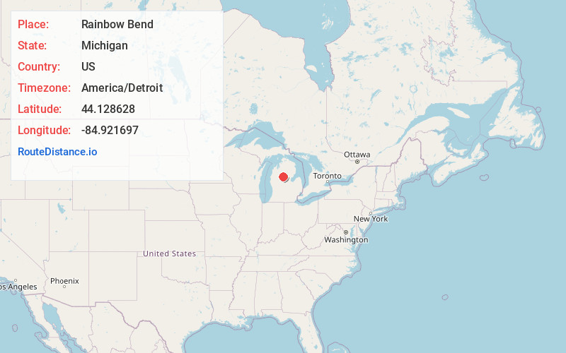
Full AddressRainbow Bend, Summerfield Township, MI 48625
-
Coordinates44.1286279, -84.9216972
-
LocationSummerfield Township , Michigan , US
-
TimezoneAmerica/Detroit
-
Current Local Time12:23:47 PM America/DetroitSunday, May 25, 2025
-
Page Views0
Nearby Places
Found 10 places within 50 miles

Moddersville
6.5 mi
10.5 km
Moddersville, Holland Township, MI 49632
Get directions
Piney Woods
6.8 mi
10.9 km
Piney Woods, Hayes Township, MI 48625
Get directions
Long Lake Heights
7.6 mi
12.2 km
Long Lake Heights, Frost Township, MI 48625
Get directions
Vogel Center
7.8 mi
12.6 km
Vogel Center, Clam Union Township, MI 49657
Get directions

Harrison
9.7 mi
15.6 km
Harrison, MI 48625
Get directions
Butterfield
10.4 mi
16.7 km
Butterfield, MI 49667
Get directions

Marion
11.3 mi
18.2 km
Marion, MI 49665
Get directions

Falmouth
11.4 mi
18.3 km
Falmouth, MI 49632
Get directions
Merritt
14.0 mi
22.5 km
Merritt, MI 49667
Get directions

Houghton Lake
15.0 mi
24.1 km
Houghton Lake, MI
Get directions
Location Links
Local Weather
Weather Information
Coming soon!
Location Map
Static map view of Rainbow Bend, Michigan
Browse Places by Distance
Places within specific distances from Rainbow Bend
Short Distances
Long Distances
Click any distance to see all places within that range from Rainbow Bend. Distances shown in miles (1 mile ≈ 1.61 kilometers).