Distance to Red House, Virginia

Calculating Your Route
Just a moment while we process your request...
Location Information
-
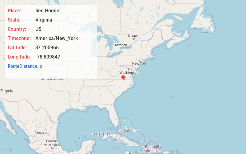
Full AddressRed House, VA 23963
-
Coordinates37.2009657, -78.8098465
-
LocationRed House , Virginia , US
-
TimezoneAmerica/New_York
-
Current Local Time9:40:27 AM America/New_YorkWednesday, June 18, 2025
-
Page Views1
About Red House
Red House is a small unincorporated community in Charlotte County, Virginia, United States.
Nearby Places
Found 10 places within 50 miles

Wren
6.1 mi
9.8 km
Wren, VA 23959
Get directions
Rough Creek
6.3 mi
10.1 km
Rough Creek, VA 23959
Get directions
Madisonville
6.7 mi
10.8 km
Madisonville, VA 23923
Get directions
Spring Mills
6.7 mi
10.8 km
Spring Mills, VA 24538
Get directions
Hat Creek
7.7 mi
12.4 km
Hat Creek, VA 24528
Get directions
Pamplin
8.3 mi
13.4 km
Pamplin, VA 23958
Get directions
Evergreen
8.5 mi
13.7 km
Evergreen, VA 24522
Get directions
Phenix
9.0 mi
14.5 km
Phenix, VA
Get directions

Sherwill
10.0 mi
16.1 km
Sherwill, VA 24538
Get directions
Shields
10.3 mi
16.6 km
Shields, VA 23958
Get directions
Location Links
Local Weather
Weather Information
Coming soon!
Location Map
Static map view of Red House, Virginia
Browse Places by Distance
Places within specific distances from Red House
Short Distances
Long Distances
Click any distance to see all places within that range from Red House. Distances shown in miles (1 mile ≈ 1.61 kilometers).