Distance to Red Rock, Alabama

Calculating Your Route
Just a moment while we process your request...
Location Information
-
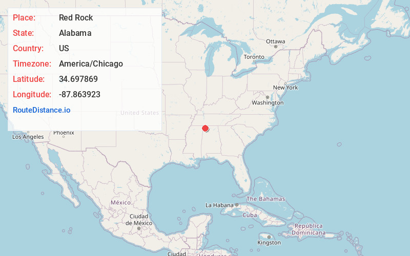
Full AddressRed Rock, AL 35674
-
Coordinates34.6978686, -87.863923
-
LocationAlabama , US
-
TimezoneAmerica/Chicago
-
Current Local Time5:14:07 AM America/ChicagoMonday, June 23, 2025
-
Page Views0
Nearby Places
Found 10 places within 50 miles

Colbert County
2.0 mi
3.2 km
Colbert County, AL
Get directions

Cedar Hills Estates
6.3 mi
10.1 km
Cedar Hills Estates, AL 35674
Get directions
Smithsonia
6.7 mi
10.8 km
Smithsonia, AL 35633
Get directions
Cherokee
7.4 mi
11.9 km
Cherokee, AL 35616
Get directions
Rivermont
8.3 mi
13.4 km
Rivermont, Sheffield, AL 35660
Get directions
Crooked Oak
8.6 mi
13.8 km
Crooked Oak, AL 35674
Get directions

Mt Hester
8.7 mi
14.0 km
Mt Hester, AL 35616
Get directions
Milk Springs
8.7 mi
14.0 km
Milk Springs, AL 35674
Get directions
Village Number 1
8.8 mi
14.2 km
Village Number 1, Sheffield, AL 35660
Get directions

Tuscumbia
9.5 mi
15.3 km
Tuscumbia, AL 35674
Get directions
Location Links
Local Weather
Weather Information
Coming soon!
Location Map
Static map view of Red Rock, Alabama
Browse Places by Distance
Places within specific distances from Red Rock
Short Distances
Long Distances
Click any distance to see all places within that range from Red Rock. Distances shown in miles (1 mile ≈ 1.61 kilometers).