Distance to River Bend, Georgia

Calculating Your Route
Just a moment while we process your request...
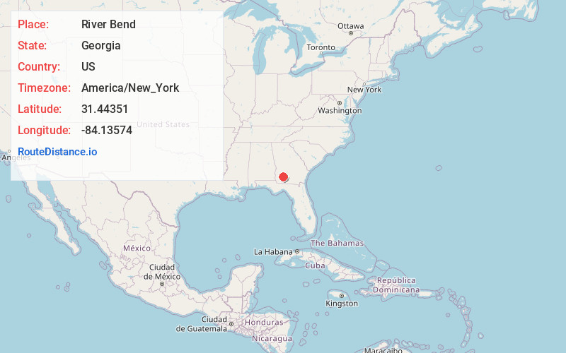
Location Information
-
Full AddressRiver Bend, Putney, GA 31705
-
Coordinates31.4435104, -84.1357395
-
LocationPutney , Georgia , US
-
TimezoneAmerica/New_York
-
Current Local Time4:38:36 AM America/New_YorkSunday, June 22, 2025
-
Page Views0
Nearby Places
Found 10 places within 50 miles

Putney
2.1 mi
3.4 km
Putney, GA 31705
Get directions

Baconton
4.7 mi
7.6 km
Baconton, GA 31716
Get directions

Albany
9.4 mi
15.1 km
Albany, GA
Get directions

Sale City
14.1 mi
22.7 km
Sale City, GA 31784
Get directions

Newton
14.9 mi
24.0 km
Newton, GA
Get directions

Camilla
15.3 mi
24.6 km
Camilla, GA 31730
Get directions

Doerun
15.5 mi
24.9 km
Doerun, GA 31744
Get directions
Gammage
16.7 mi
26.9 km
Gammage, GA 31791
Get directions

Sylvester
18.7 mi
30.1 km
Sylvester, GA 31791
Get directions

Leesburg
20.0 mi
32.2 km
Leesburg, GA 31763
Get directions
Location Links
Local Weather
Weather Information
Coming soon!
Location Map
Static map view of River Bend, Georgia
Browse Places by Distance
Places within specific distances from River Bend
Short Distances
Long Distances
Click any distance to see all places within that range from River Bend. Distances shown in miles (1 mile ≈ 1.61 kilometers).