Distance to Saulsburg, Arkansas

Calculating Your Route
Just a moment while we process your request...
Location Information
-
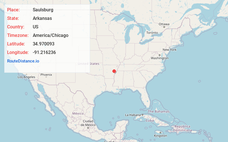
Full AddressSaulsburg, AR 72036
-
Coordinates34.9700927, -91.2162363
-
LocationArkansas , US
-
TimezoneAmerica/Chicago
-
Current Local Time5:32:14 PM America/ChicagoSaturday, May 31, 2025
-
Page Views0
Nearby Places
Found 10 places within 50 miles

Fargo
2.3 mi
3.7 km
Fargo, AR 72021
Get directions

Cotton Plant
3.1 mi
5.0 km
Cotton Plant, AR 72036
Get directions
Zent
3.1 mi
5.0 km
Zent, AR 72021
Get directions
Casey
5.4 mi
8.7 km
Casey, AR 72036
Get directions
Posey
5.8 mi
9.3 km
Posey, AR 72392
Get directions

Brinkley
5.9 mi
9.5 km
Brinkley, AR 72021
Get directions
Daggett
7.4 mi
11.9 km
Daggett, AR 72040
Get directions

Wheatley
7.4 mi
11.9 km
Wheatley, AR 72392
Get directions
Hunter
7.7 mi
12.4 km
Hunter, AR
Get directions
Eden
8.1 mi
13.0 km
Eden, AR 72021
Get directions
Location Links
Local Weather
Weather Information
Coming soon!
Location Map
Static map view of Saulsburg, Arkansas
Browse Places by Distance
Places within specific distances from Saulsburg
Short Distances
Long Distances
Click any distance to see all places within that range from Saulsburg. Distances shown in miles (1 mile ≈ 1.61 kilometers).