Distance to Shady Grove, Kentucky

Calculating Your Route
Just a moment while we process your request...
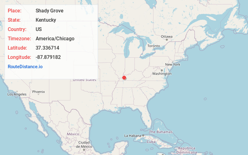
Location Information
-
Full AddressShady Grove, KY 42064
-
Coordinates37.3367143, -87.8791822
-
LocationKentucky , US
-
TimezoneAmerica/Chicago
-
Current Local Time1:13:18 AM America/ChicagoThursday, June 19, 2025
-
Page Views0
About Shady Grove
Shady Grove is an unincorporated community in Crittenden County, Kentucky, United States.
Nearby Places
Found 10 places within 50 miles

Providence
7.7 mi
12.4 km
Providence, KY 42450
Get directions

Derby
8.6 mi
13.8 km
Derby, KY 42404
Get directions
Flat Rock
8.6 mi
13.8 km
Flat Rock, KY 42411
Get directions
Kirkwood Springs
8.6 mi
13.8 km
Kirkwood Springs, KY 42408
Get directions
Farmersville
9.4 mi
15.1 km
Farmersville, KY 42445
Get directions

Clay
10.2 mi
16.4 km
Clay, KY 42404
Get directions
Wheatcroft
10.6 mi
17.1 km
Wheatcroft, KY
Get directions

Marion
11.1 mi
17.9 km
Marion, KY 42064
Get directions
Crayne
12.1 mi
19.5 km
Crayne, KY
Get directions

Fredonia
13.2 mi
21.2 km
Fredonia, KY 42411
Get directions
Location Links
Local Weather
Weather Information
Coming soon!
Location Map
Static map view of Shady Grove, Kentucky
Browse Places by Distance
Places within specific distances from Shady Grove
Short Distances
Long Distances
Click any distance to see all places within that range from Shady Grove. Distances shown in miles (1 mile ≈ 1.61 kilometers).