Distance to Standing Pine, Mississippi

Calculating Your Route
Just a moment while we process your request...
Location Information
-
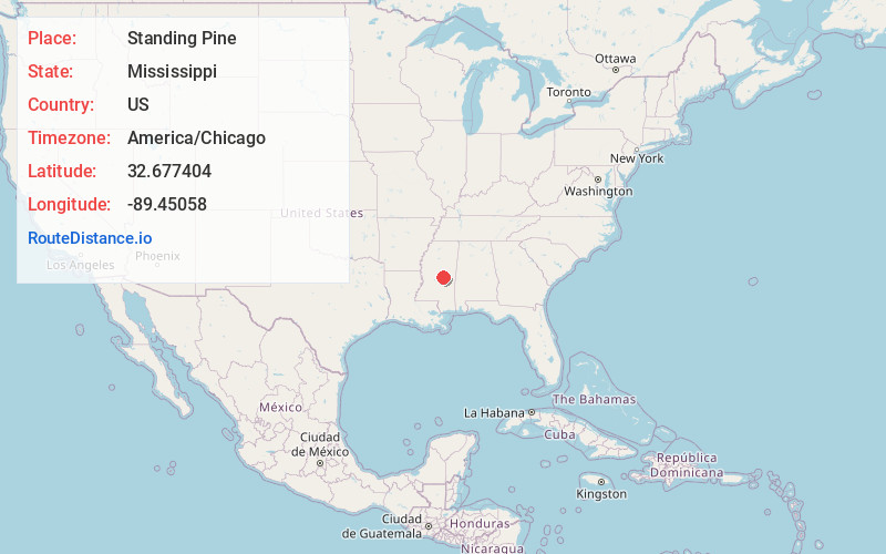
Full AddressStanding Pine, MS
-
Coordinates32.6774036, -89.4505802
-
LocationStanding Pine , Mississippi , US
-
TimezoneAmerica/Chicago
-
Current Local Time5:09:50 AM America/ChicagoFriday, May 30, 2025
-
Page Views0
About Standing Pine
Standing Pine is a census-designated place in Leake County, Mississippi, United States. It is one of the eight communities of the Mississippi Band of Choctaw Indians Reservation, and the population is 94% Choctaw. The total population of the CDP was 517 at the 2020 census.
Nearby Places
Found 10 places within 50 miles

Walnut Grove
6.0 mi
9.7 km
Walnut Grove, MS 39189
Get directions

Carthage
6.3 mi
10.1 km
Carthage, MS 39051
Get directions

Pearl River
14.9 mi
24.0 km
Pearl River, MS 39350
Get directions
Hillsboro
15.5 mi
24.9 km
Hillsboro, MS 39074
Get directions
Conehatta
18.4 mi
29.6 km
Conehatta, MS 39057
Get directions

Philadelphia
20.5 mi
33.0 km
Philadelphia, MS 39350
Get directions

Union
20.5 mi
33.0 km
Union, MS 39365
Get directions

Forest
21.7 mi
34.9 km
Forest, MS 39074
Get directions

Morton
25.3 mi
40.7 km
Morton, MS 39117
Get directions

Decatur
25.9 mi
41.7 km
Decatur, MS 39327
Get directions
Location Links
Local Weather
Weather Information
Coming soon!
Location Map
Static map view of Standing Pine, Mississippi
Browse Places by Distance
Places within specific distances from Standing Pine
Short Distances
Long Distances
Click any distance to see all places within that range from Standing Pine. Distances shown in miles (1 mile ≈ 1.61 kilometers).